Ebro Natural Path – Stage 42: Amposta – Riumar (old GR‑99)
Final stage of the Ebro Natural Path, which connects Amposta with the mouth of the river, passing through Deltebre, Muntell de les Verges and the Zigurat Viewpoint, until reaching the Riumar promenade.
Route characteristics
- 28,46 km
- 44 m
- 10 m
![]() No traffic No motorized vehicles allowed.
No traffic No motorized vehicles allowed.
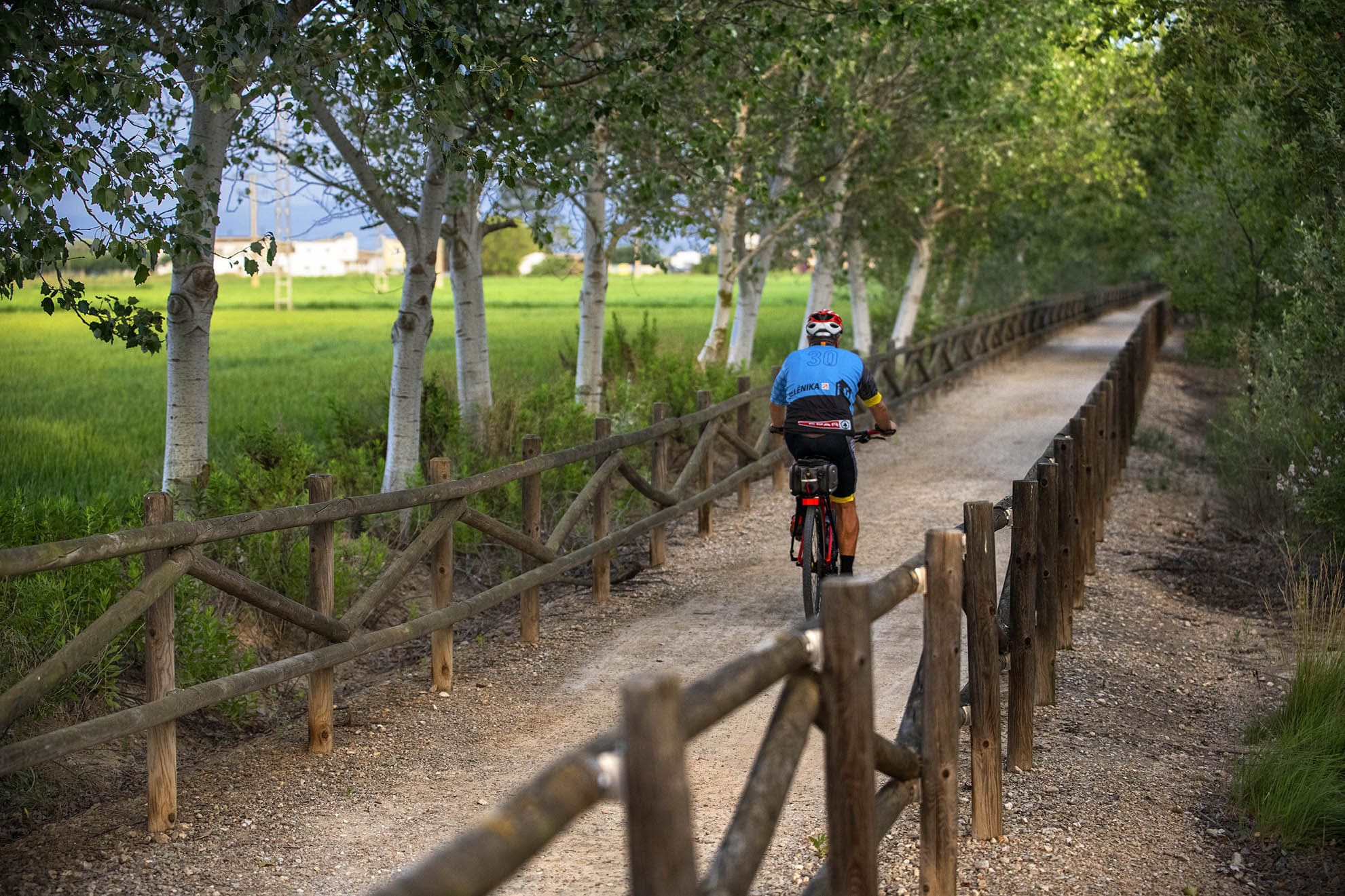
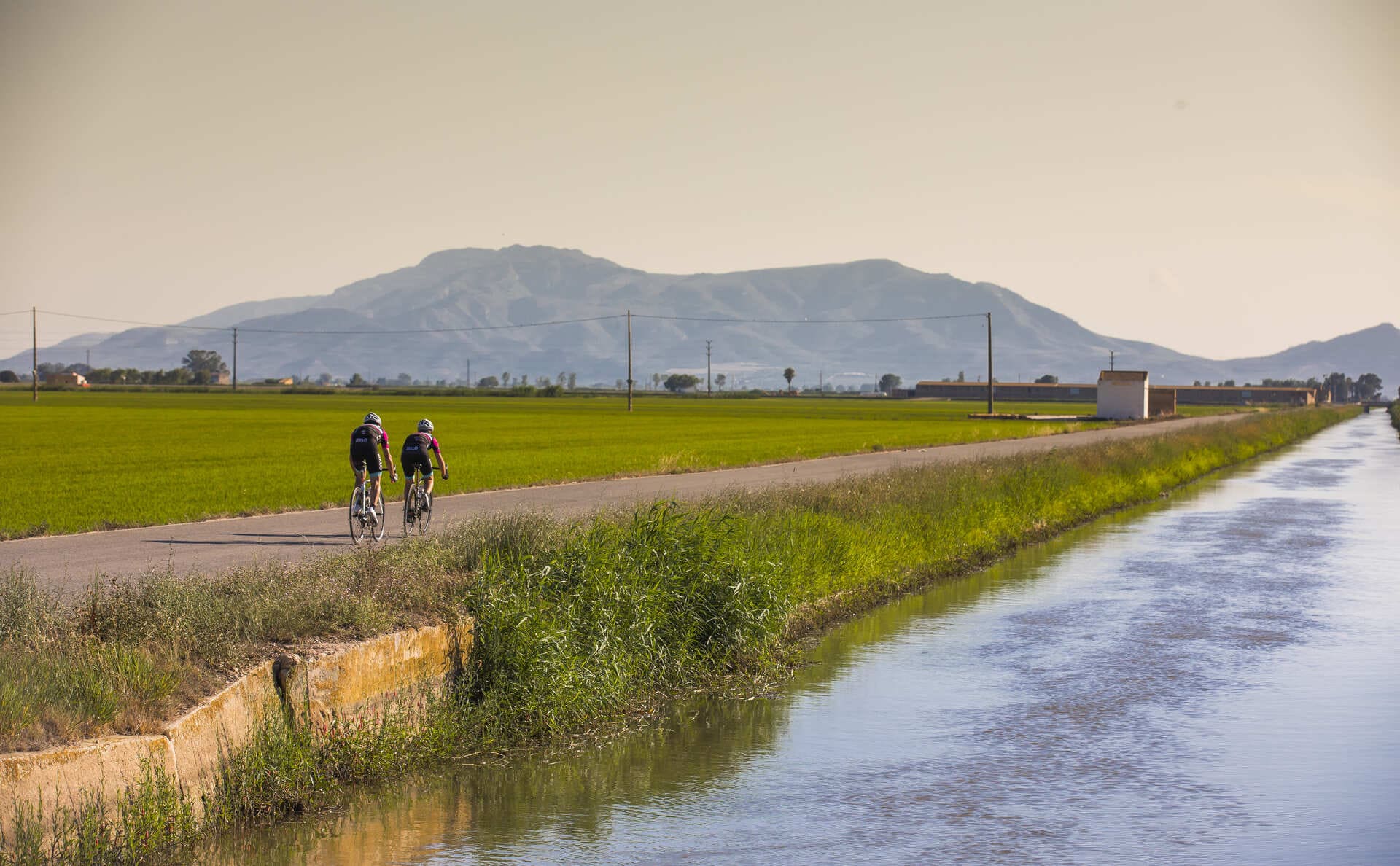
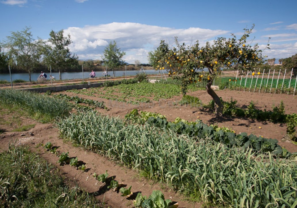
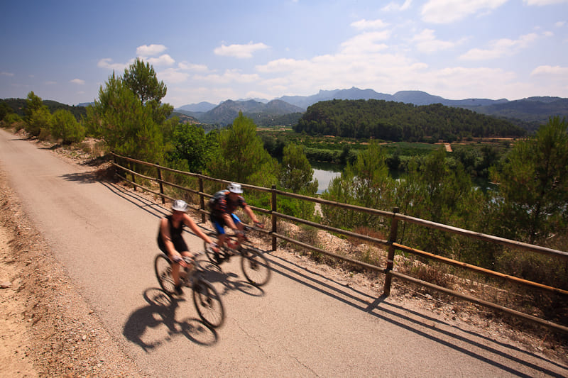
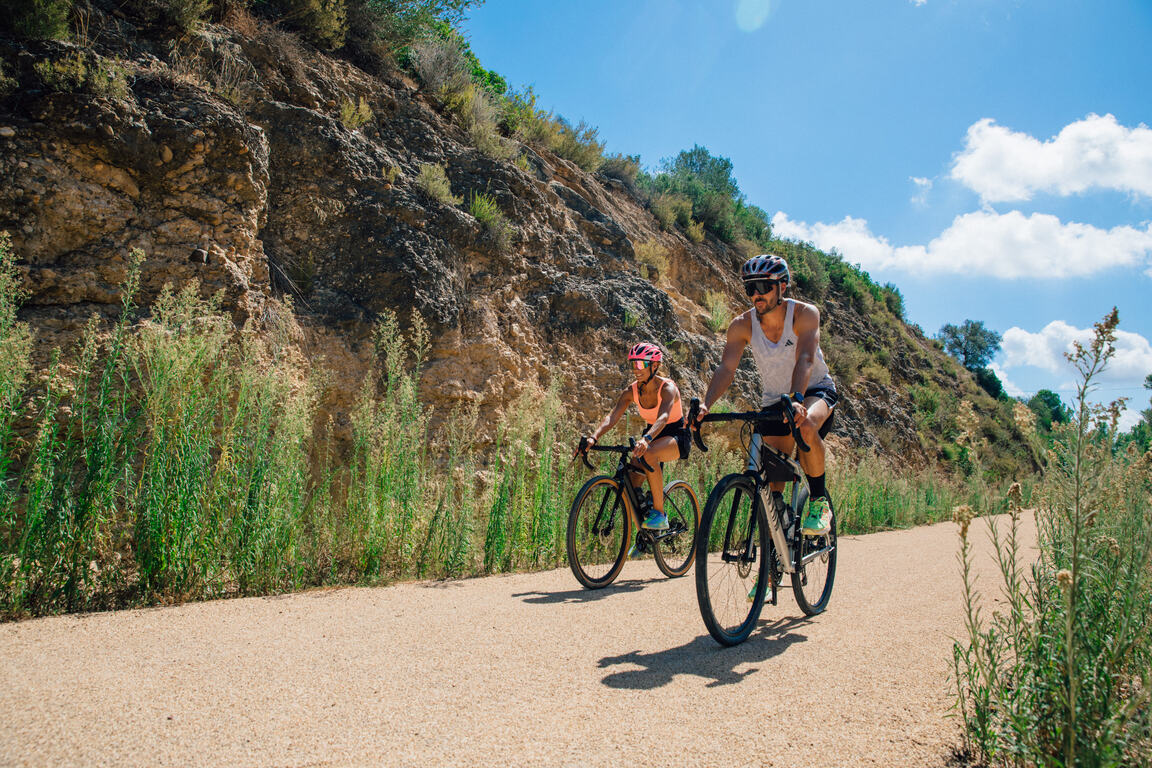
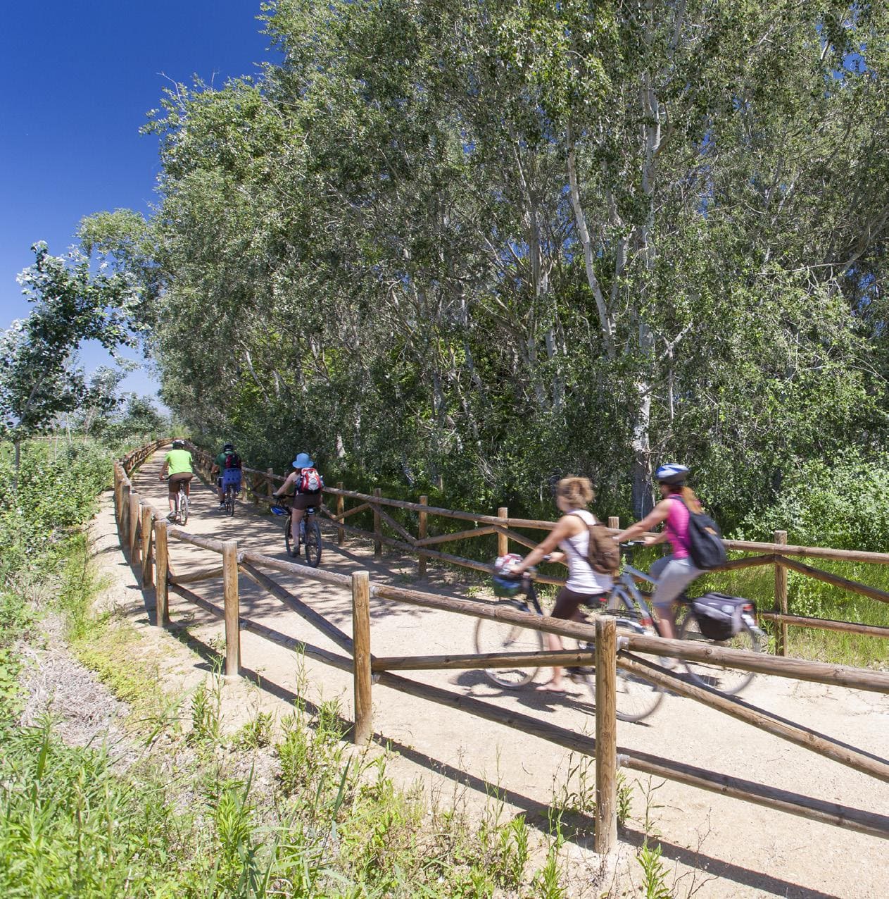
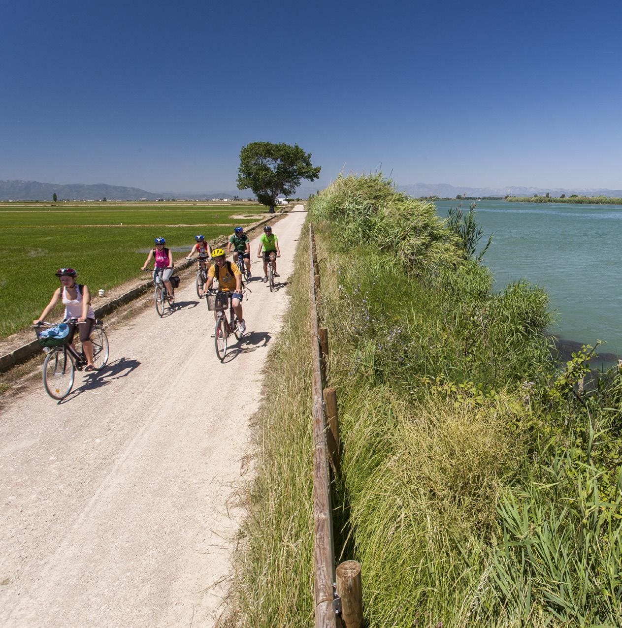
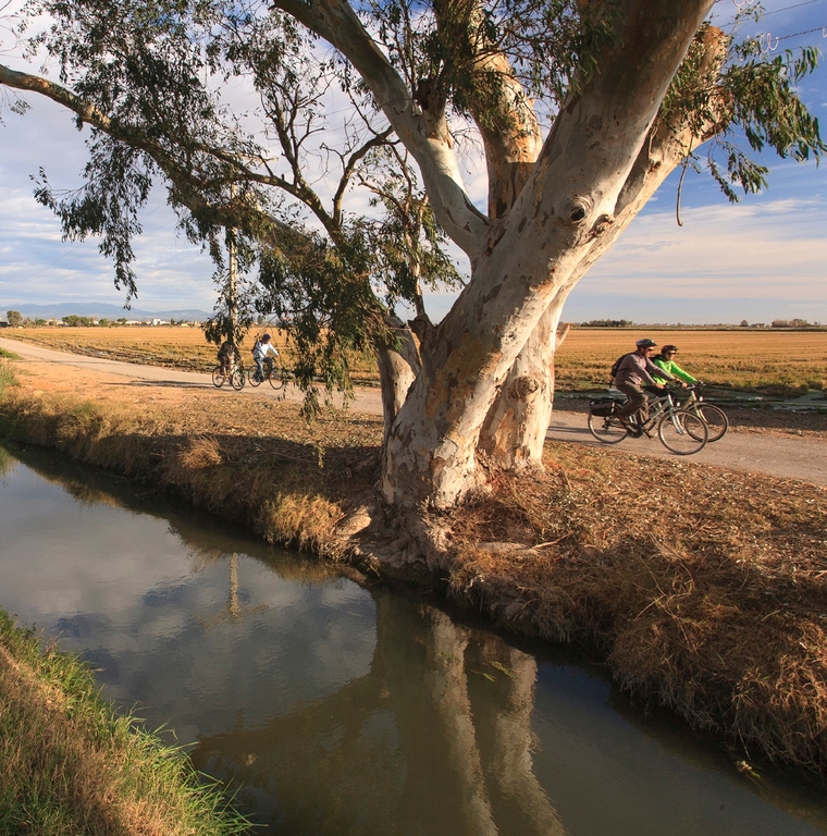
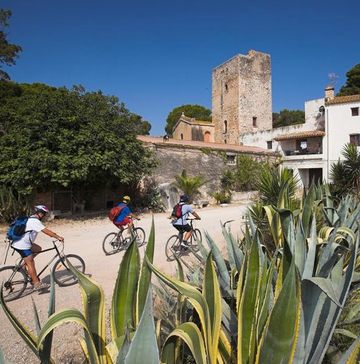
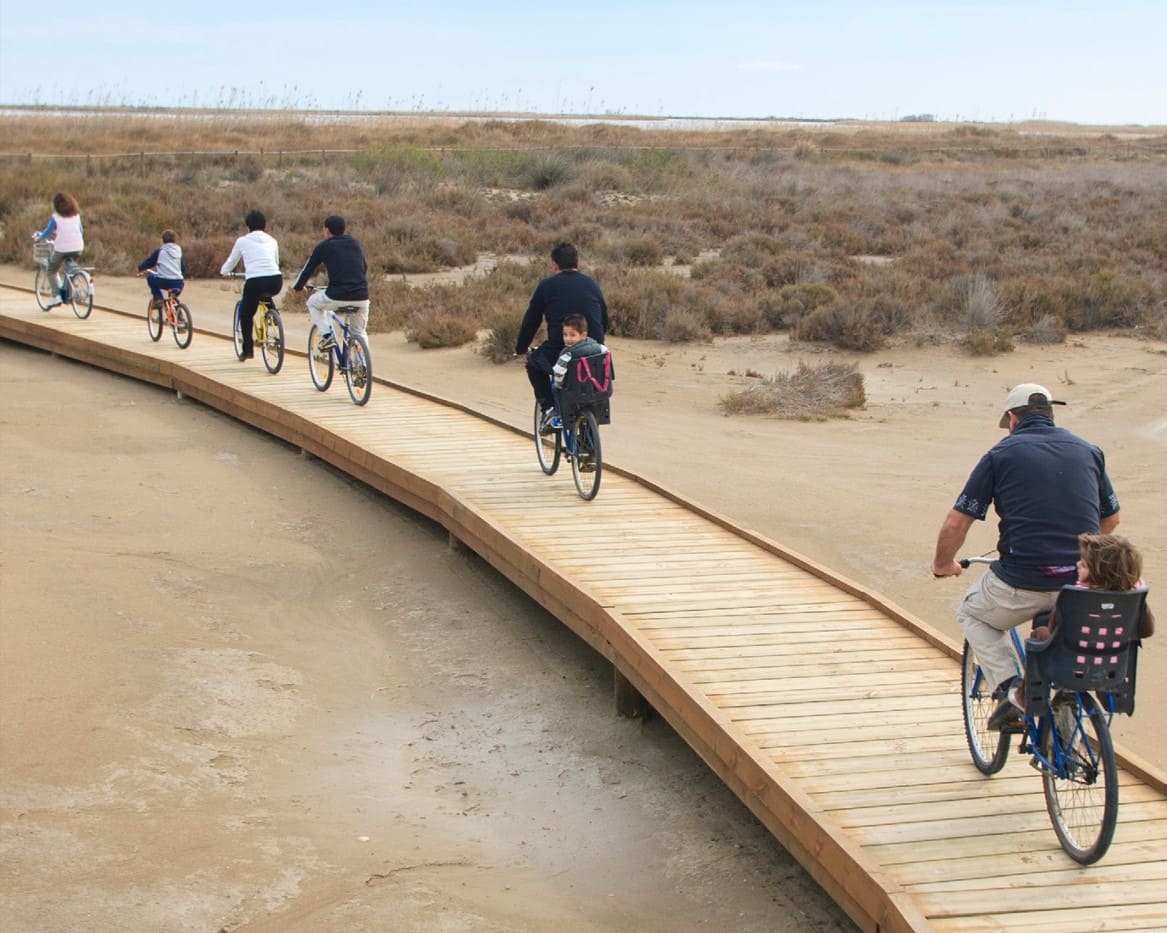
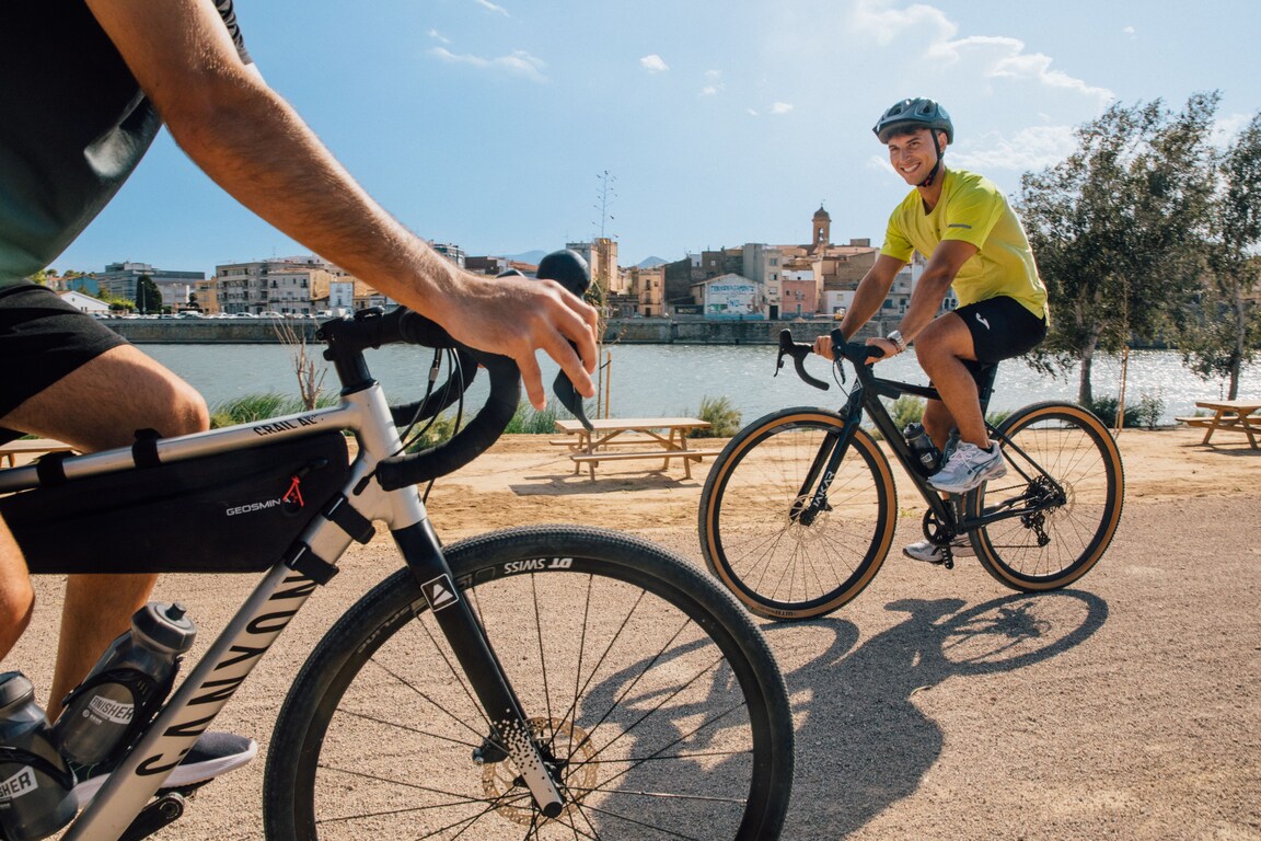
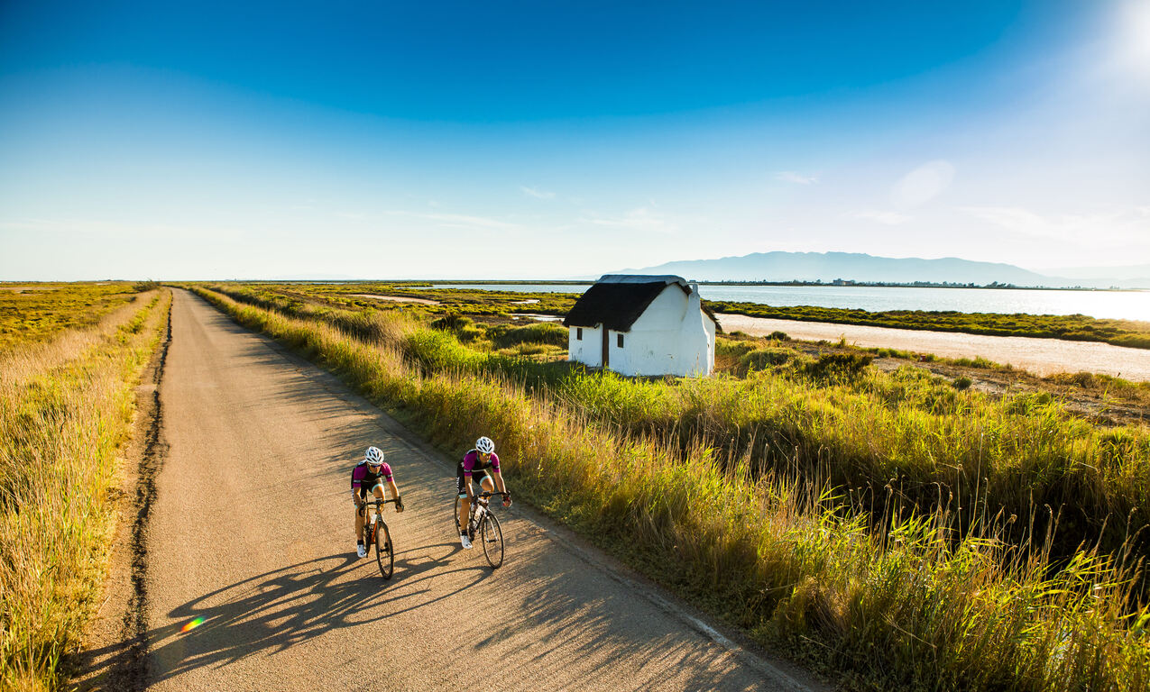
Last stage of the Camí Natural de l'Ebre, which closes the route with a long and flat stretch of 24–25 km between Amposta and the mouth of the river in Riumar, crossing the Ebro Delta Natural Park and the large rice fields formed in the new alluvial lands. The route begins in Amposta crossing the Pont Penjant and following the riverbank, with paths protected by wooden railings and interpretive panels that show the riverbank vegetation and the restoration of the poplar and oleander forests.
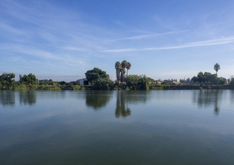
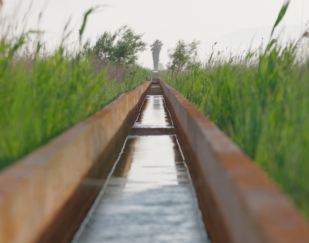
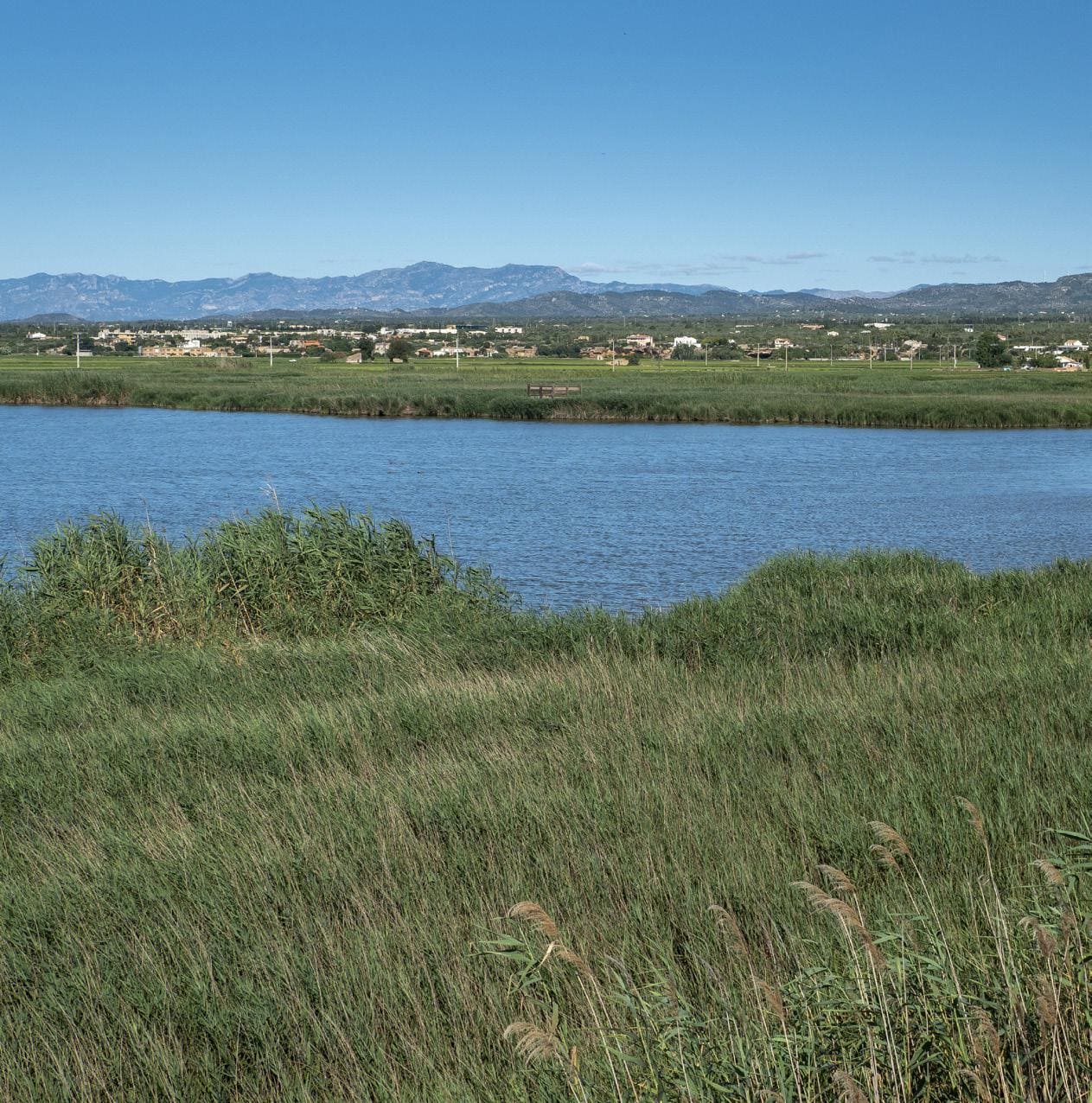
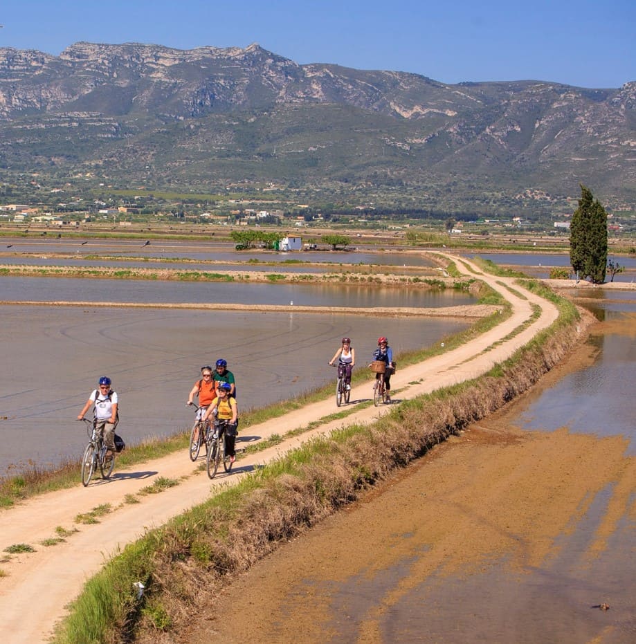
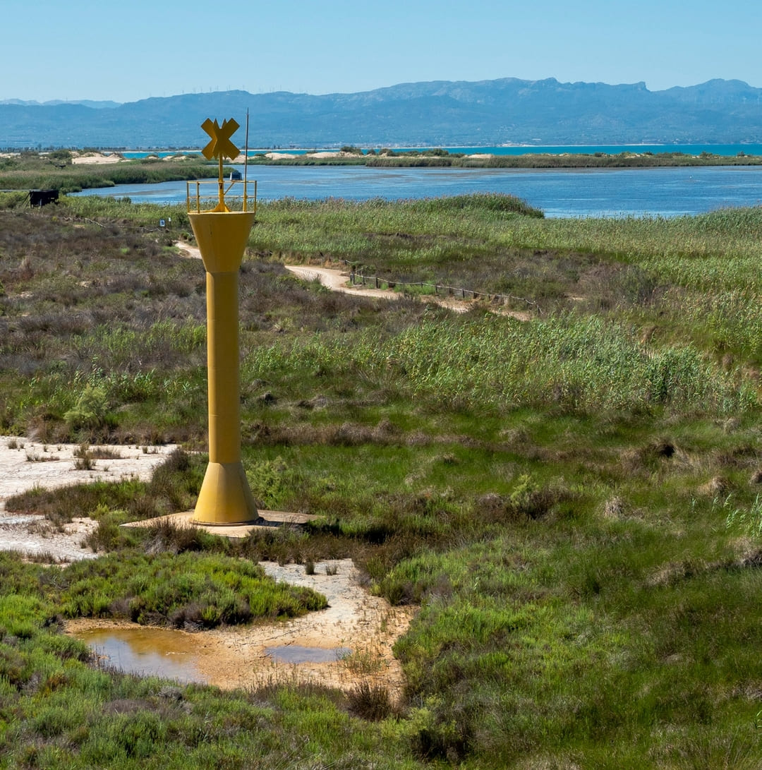
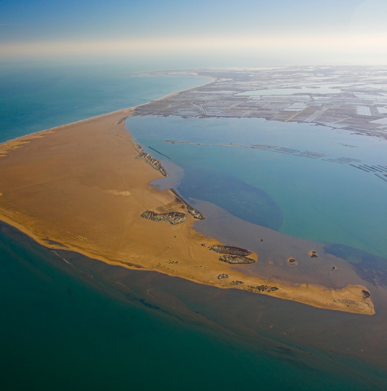
The route follows the river and passes through areas of interest such as Sapinya Island and Gràcia Island, traditional piers and beach bars, allowing you to observe the typical fauna of the delta and navigation at the mouth. The itineraries cross canals and paved passages between rice fields, recreational areas and neighborhoods of Deltebre, with viewpoints such as the Muntell de les Verges and the Garxal lighthouse that offer privileged views of the lagoon and the sea.
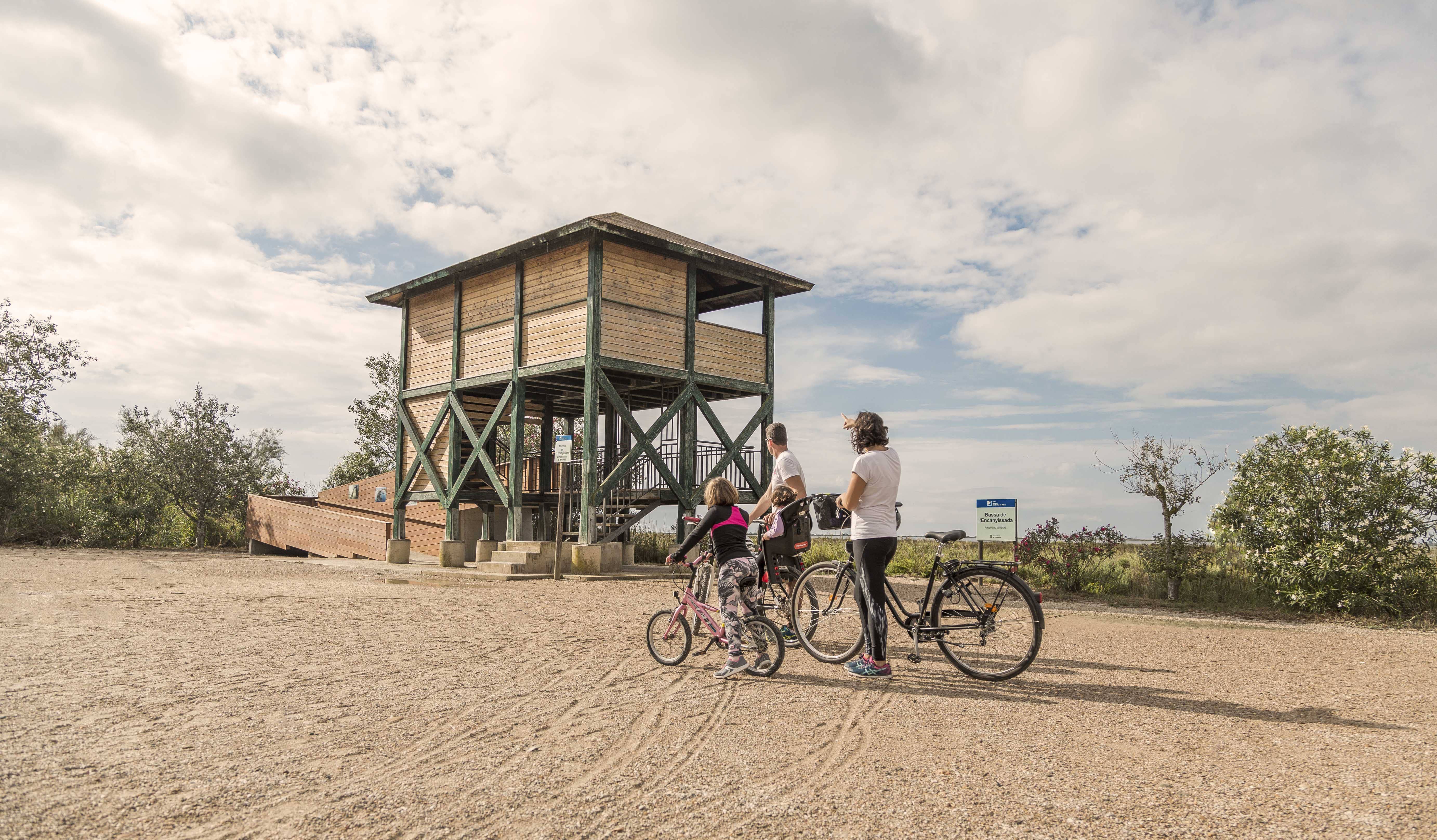
The stage ends in the Riumar urbanization, on the promenade, where the Ebro Natural Path culminates in a space equipped with wildlife observation points and interpretive itineraries, allowing you to enjoy a final complete immersion in the unique landscape of the delta, combining nature, agriculture and fluvial heritage.
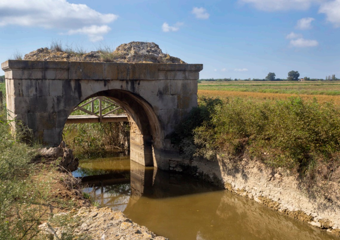
The Sínia
A stone construction with two wheels, it was originally intended to raise the water from the river for agricultural use. Waterwheels were very widespread during the centuries of Muslim occupation.
Island of Gracia
Privately owned, much of its surface is dedicated to agricultural exploitation. From Balada we can enjoy good views of its riverside forest.
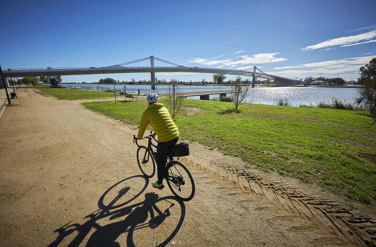
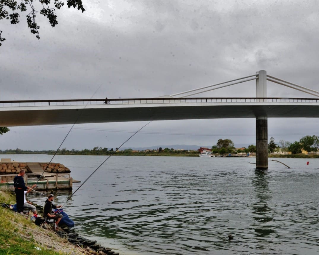
Bridge The Passador
250 meters long and 15 meters high, its design allocates half of the surface area to cyclists and pedestrians. There is also an exhibition on the history of ferries.
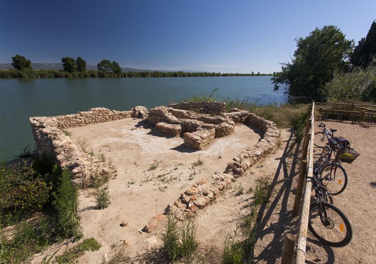
Moors' Bridge
Remains of two semicircular arches made of rough stone, part of a gate or sluice that regulated the water of ancient salt pans near the Ebro River.
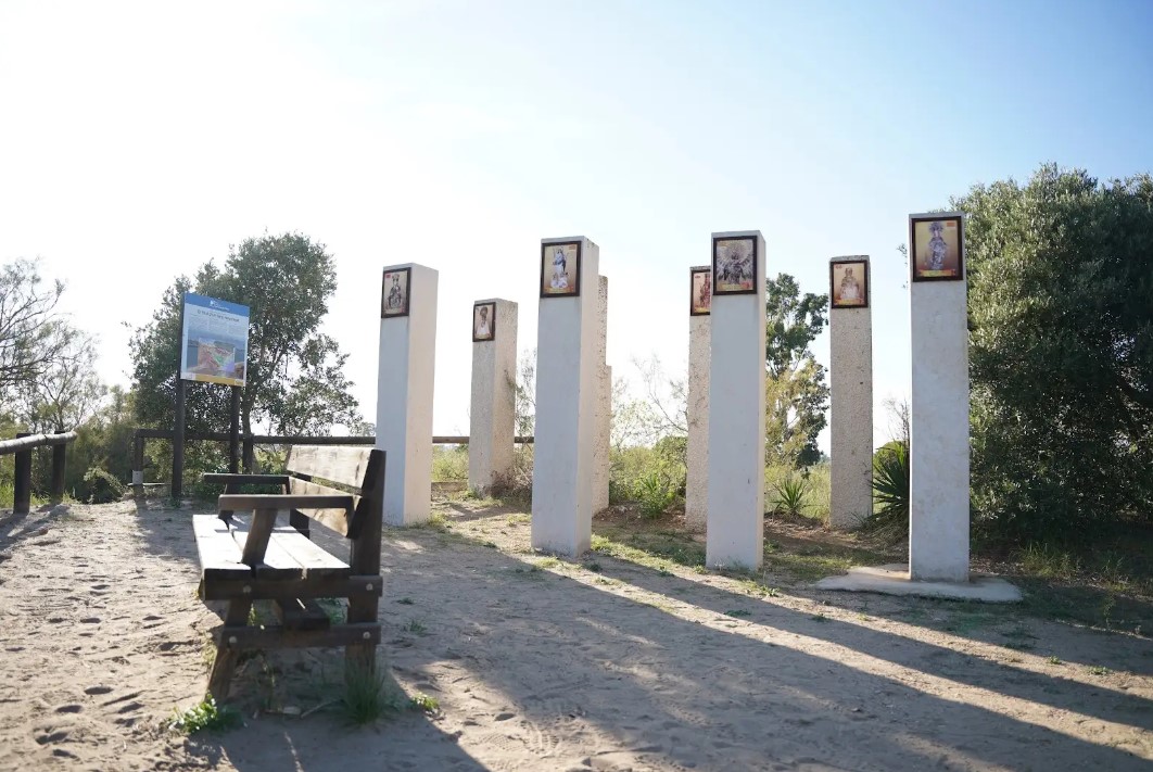
Hill of the Virgins
A 4 m high fluvial dune located on the left bank of the Ebro River where we find a monument with seven columns dedicated to the Marian invocations of the communities through which the Ebro River passes.
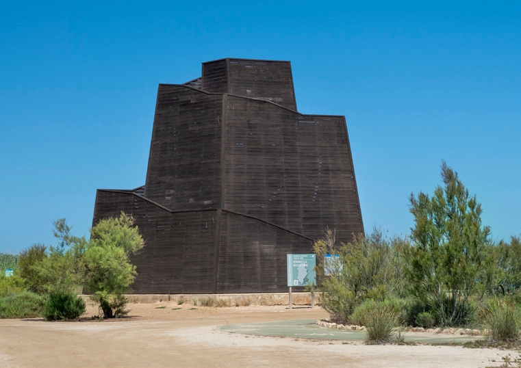
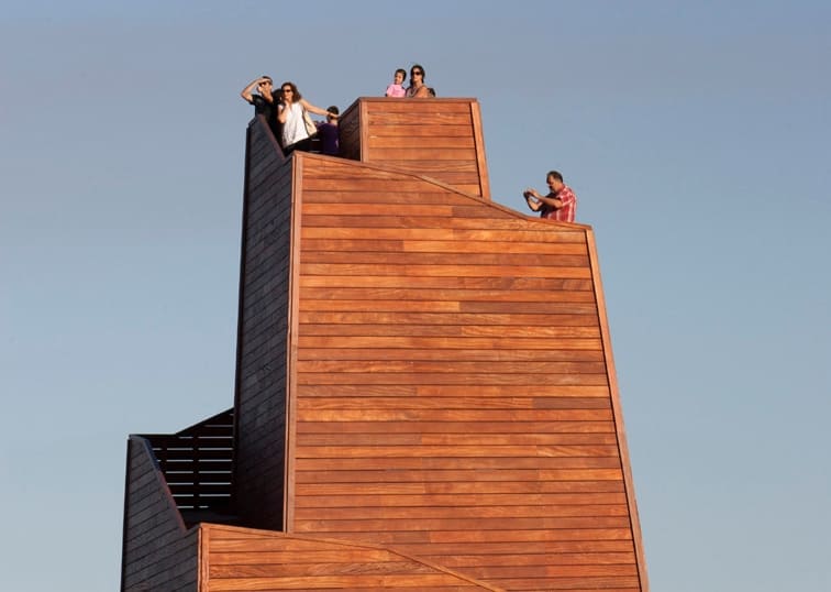
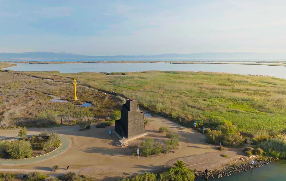
Ziggurat Viewpoint
A wooden viewpoint about 12 m high located at the mouth of the Ebro. It was inaugurated in 2015 and is one of the most popular points of interest in the Delta. It offers unbeatable panoramic views.
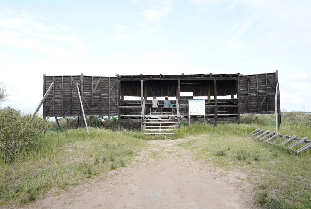
Adapted viewpoint of Garxal
Wildlife viewpoint located in the Garxal pond. It is ideal for wildlife lovers, to observe a wide variety of birds and other animals. The maximum capacity is 10 people.
Tips
- You must wear a helmet and bring food and enough water. Carry your phone and keep it charged; in case of emergency, call 112. Depending on the season, it is advisable to bring sunscreen and insect repellent.
- The terrain is completely flat, but be aware of the prevailing winds in the area.
- Check the weather forecast before heading out at meteo.cat
- It is advisable to carry puncture repair equipment.
- Make use of the viewpoints, they will show you the delta landscape. Bring binoculars to watch the birds.


Amposta is a Spanish municipality and town in the province of Tarragona, in the autonomous community of Catalonia. It is the capital of the Montsià region. Located at an altitude of 8 m above sea level, on the banks of the Ebro River, the municipality has a population of 22,637 (INE 2024). Its economic activity is mainly agriculture (rice farming) and services. In the final years of the 20th century, a small but important industrial sector emerged based on the food, paper and packaging industries, furniture, and a multitude of small machinery workshops. In addition to the city of Amposta, the municipality includes the town of Poblenou del Delta and part of Balada.


Deltebre is a young municipality located at the edge of the Ebre Delta. This fet, sens dubte, clearly marks the character of the people, and also provides a clue to deduce the orography and the intrinsic characteristics of the population.
Sant Jaume d’Enveja, situat al cor del Parc Natural del Delta de l’Ebre, és un poble envoltat de camps d’arròs, llacunes i canals que defineixen el paisatge característic del delta. La seva vida tranquil·la i la gastronomia local, basada en l’arròs i els productes del riu, conviden a gaudir del territori amb calma. Els camins plans que travessen els arrossars i connecten amb altres nuclis del delta fan de Sant Jaume d’Enveja un lloc ideal per a rutes ciclistes senzilles, cosa que permet descobrir la natura, la fauna i la serenitat d’aquest entorn únic.
- As this is a linear route with various parking options along the way, you can adapt the itinerary to suit your needs and abilities.
- Please respect the signage and no-access zones.
- Lighting fires is strictly forbidden.
- Please respect the flora, fauna and environment. Collecting animal or plant species, whether alive or dead, is not permitted.
- Camping is only permitted at established campsites.
- In protected areas, dogs must be kept on a lead.
The take-off and landing of drones is forbidden. - Littering is forbidden except in designated areas.
THE ZAFÁN GREENWAY GAME
Explore, learn, and have fun with Antoni and Clara as you travel the routes of the Zafán Valley. Each stop is a new adventure, every challenge a story waiting for you!
Comença a jugar!Along your route, you'll find challenges and activities to earn points, solve clues, or win virtual prizes.
Join our games and become an expert on the Zafán Greenway.
Available games (2)
Observe birds
Find the bird-watching spot along the route, scan the QR code, and answer three questions to earn your badge.
More informationPhotograph shells
Upload a photo to Instagram of the shells you find on the beach using the hashtag #conchasdelFalgar
More information
Weather forecast
Today, Sunday, Amposta

Clouds
6 km/h
20ºC max
14ºC min
No rain forecast
Next days forecast

Monday
20º max
15º min
Tuesday
19º max
15º min

Wednesday
18º max
16º min

Thursday
18º max
16º min
Other routes you may like...
La Ràpita - Amposta - L'Aldea - Camarles - L'Ampolla (Porta del Delta)