Via Verda Val de Zafán (Complete)
From Aragón to the sea, the Val de Zafán Greenway follows the old railway line through the Terres de l’Ebre to La Ràpita, linking inland landscapes and the Mediterranean at a gentle, unhurried pace.
Route characteristics
- 154 km
- 1509 m
- 593 m
![]() No traffic No motorized vehicles allowed.
No traffic No motorized vehicles allowed.
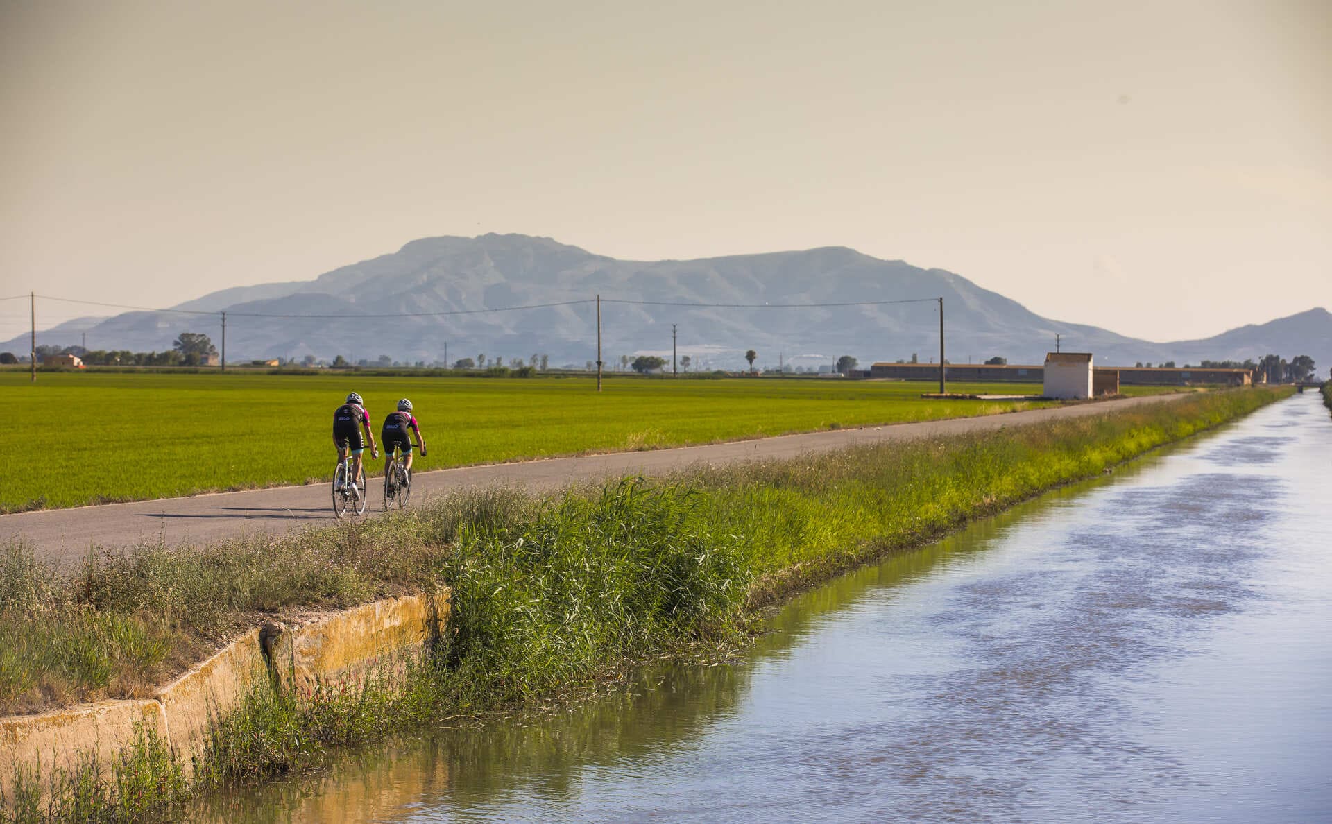
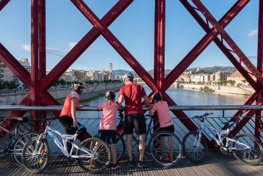
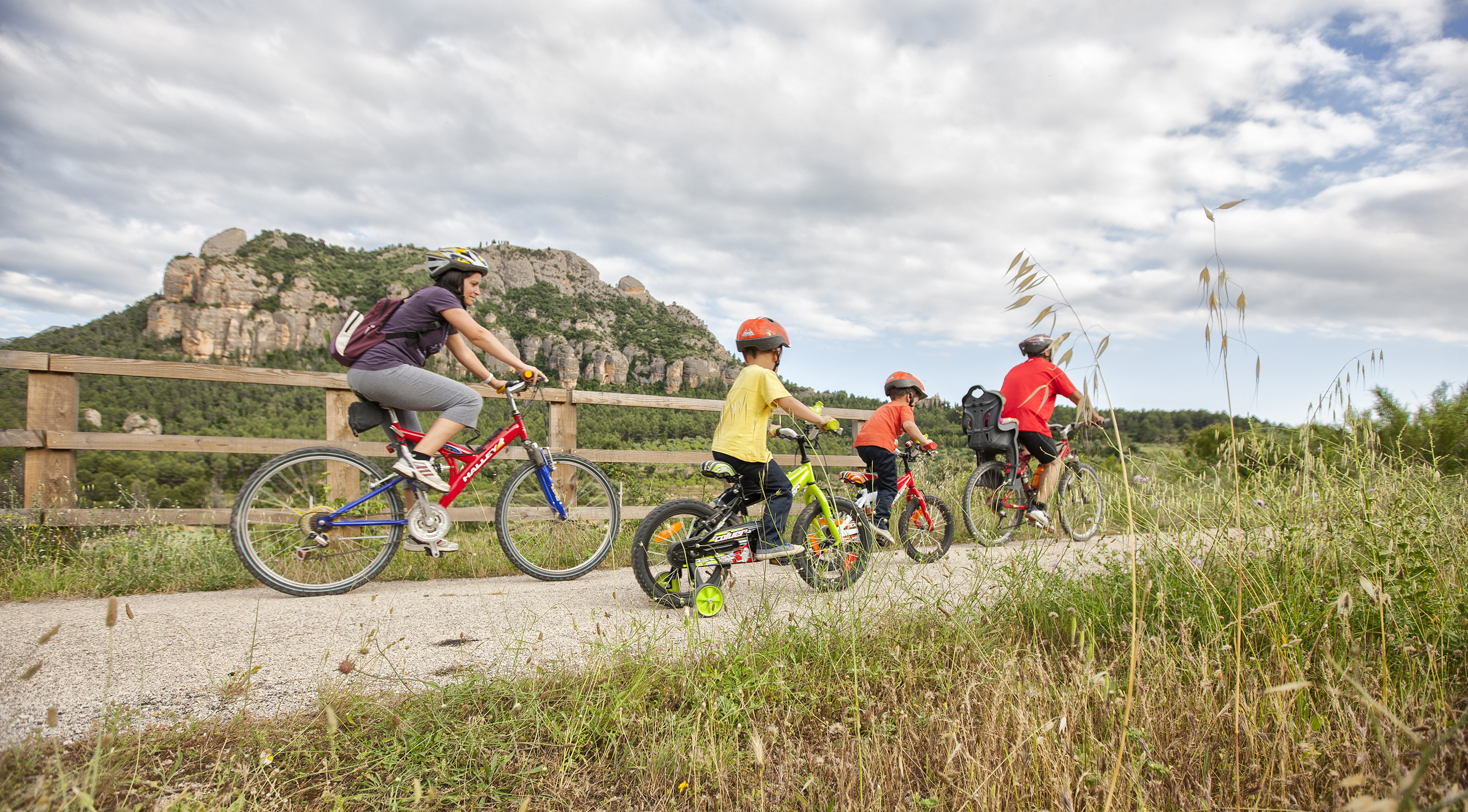
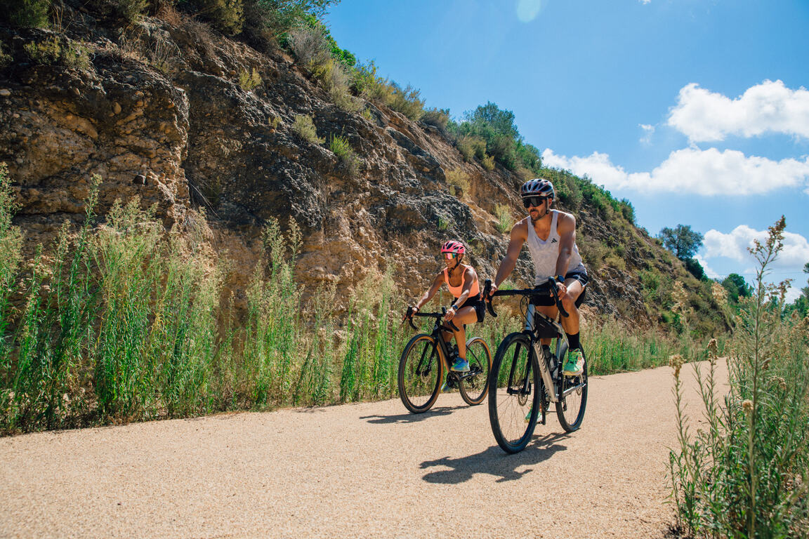
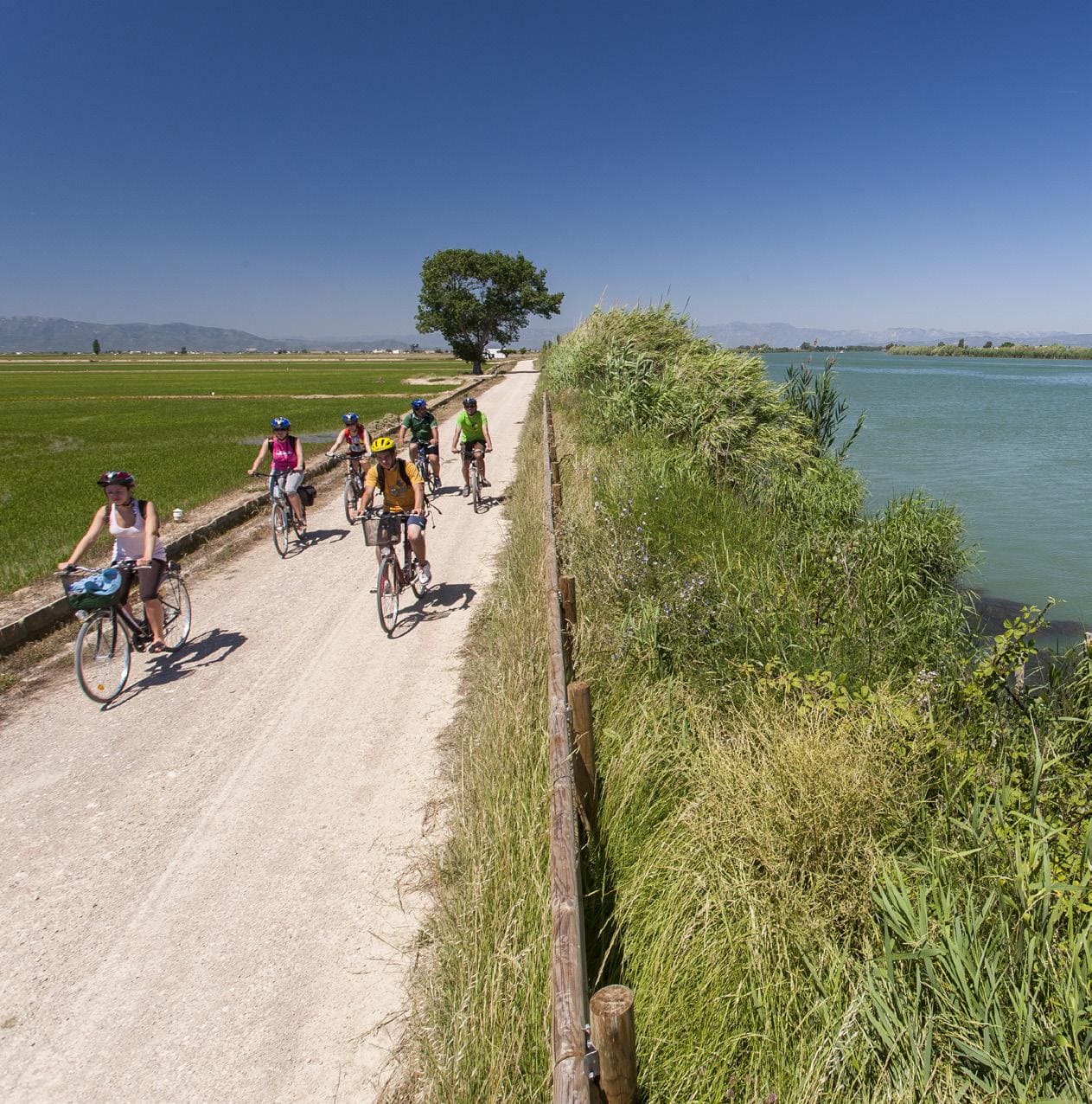
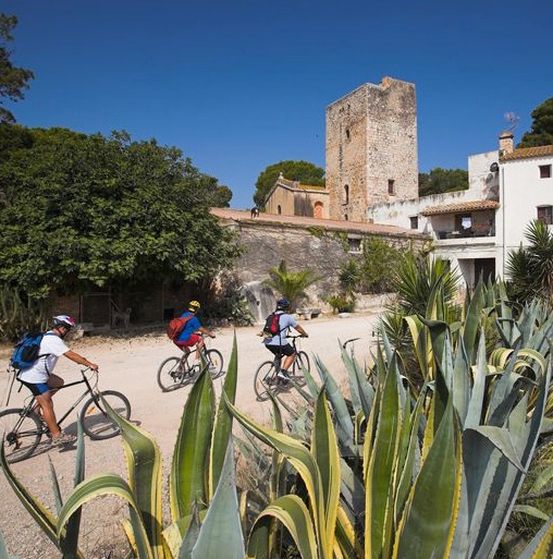
A long-distance route linking La Puebla de Híjar with La Ràpita, following in its entirety the former railway alignment of the Val de Zafán Greenway, from the Bajo Aragón region to the final Catalan section, connecting with the sea via Amposta. This is a gradual and predominantly flat itinerary that allows users to cross inland landscapes, riverside farmland and the delta plain before reaching the Mediterranean.
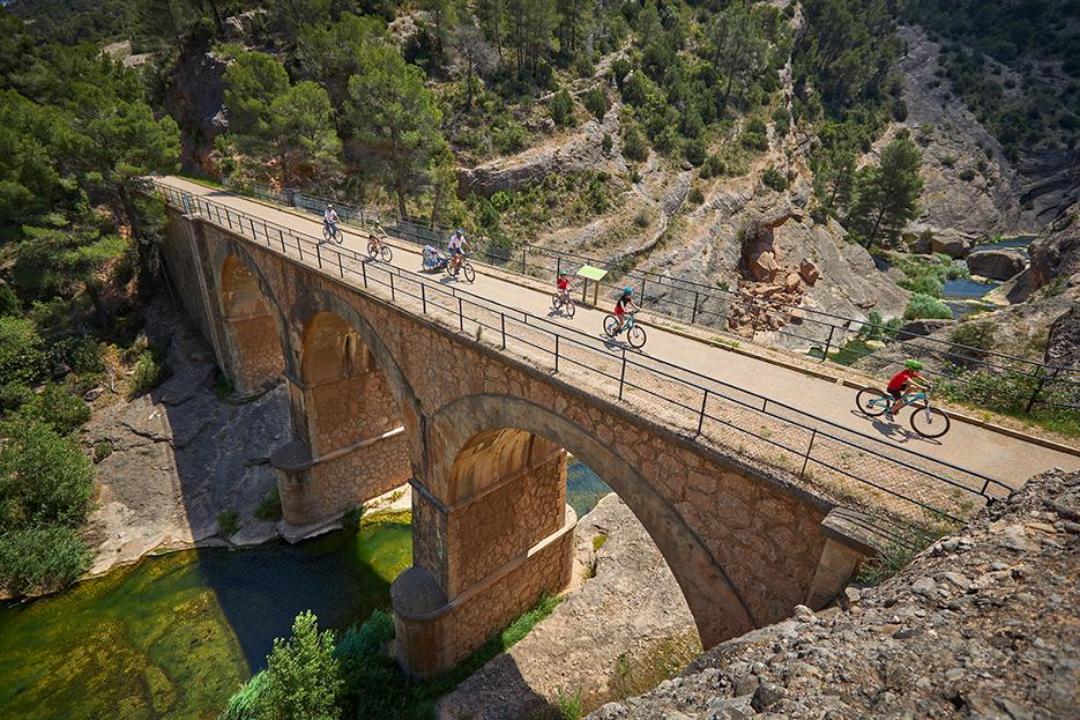
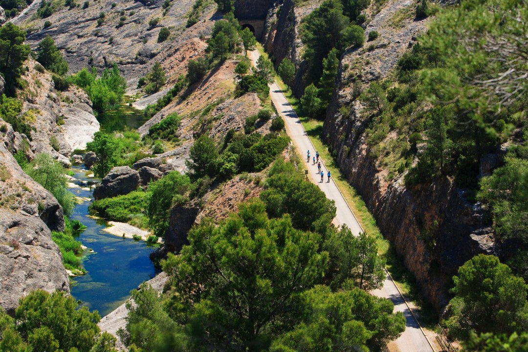
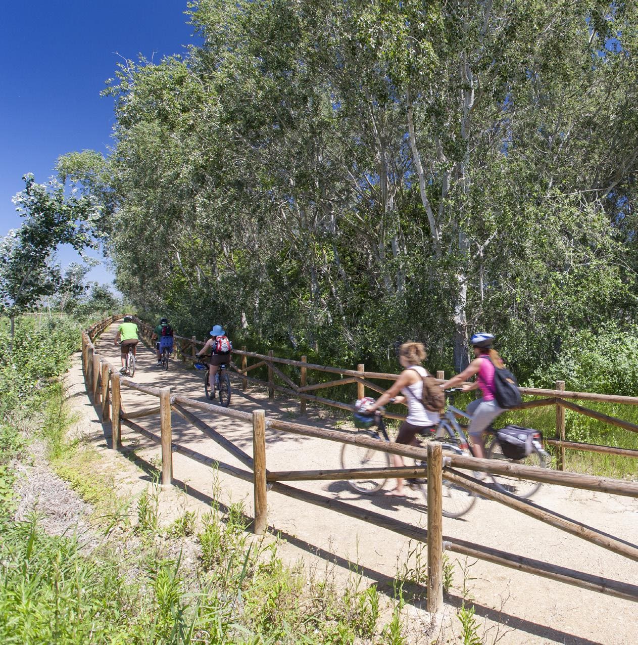
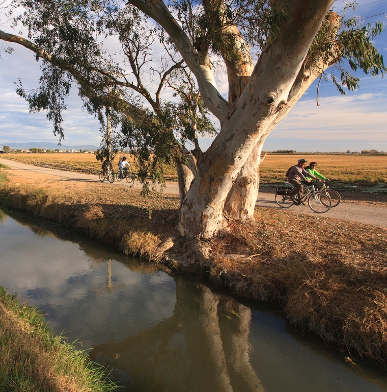
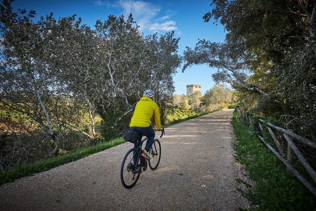
From La Puebla de Híjar, the greenway runs across former railway bridges and tunnels, passing through Alcañiz and gradually approaching the lower course of the Ebro River until reaching Tortosa. Segregated from motorised traffic and featuring a compact surface, the route is well suited for cycle touring and walking, offering a comfortable and safe experience through agricultural landscapes and natural areas.
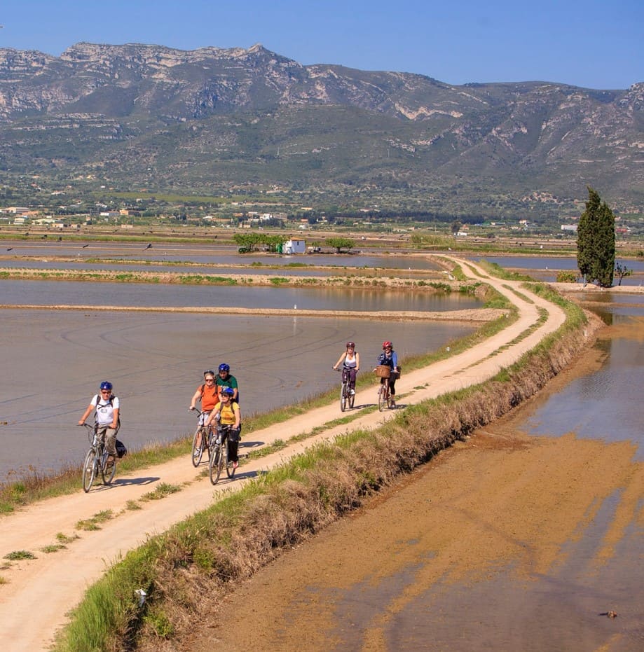
From Tortosa, the same greenway continues southwards to Amposta, maintaining its railway character and following the Ebro along a highly scenic river section. This segment reinforces the continuous cycling connection between Aragon and the Delta, fully integrated into the greenway without interruptions.
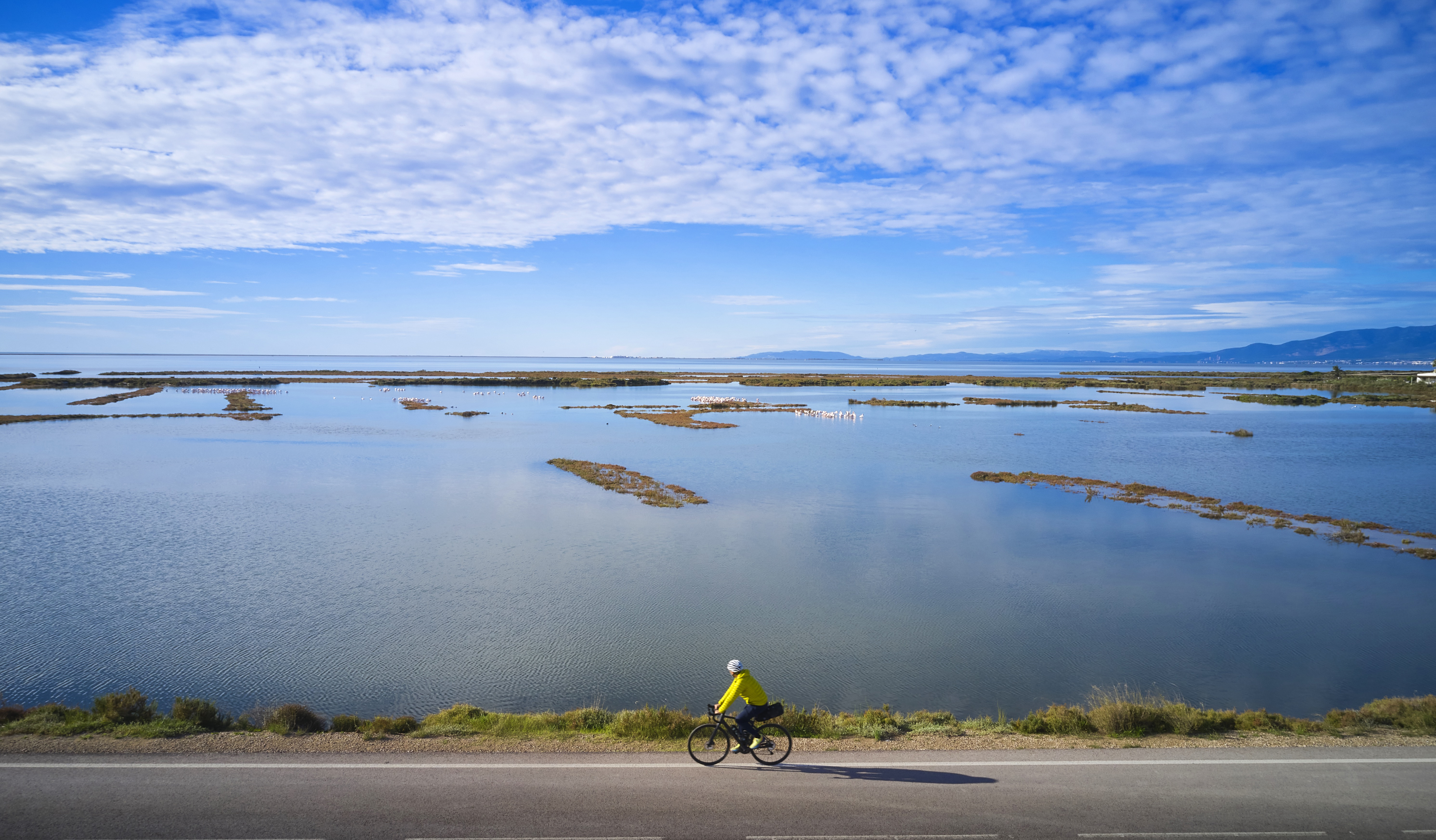
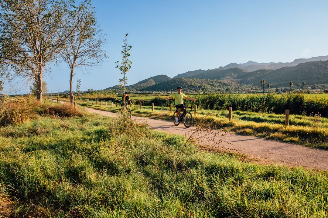
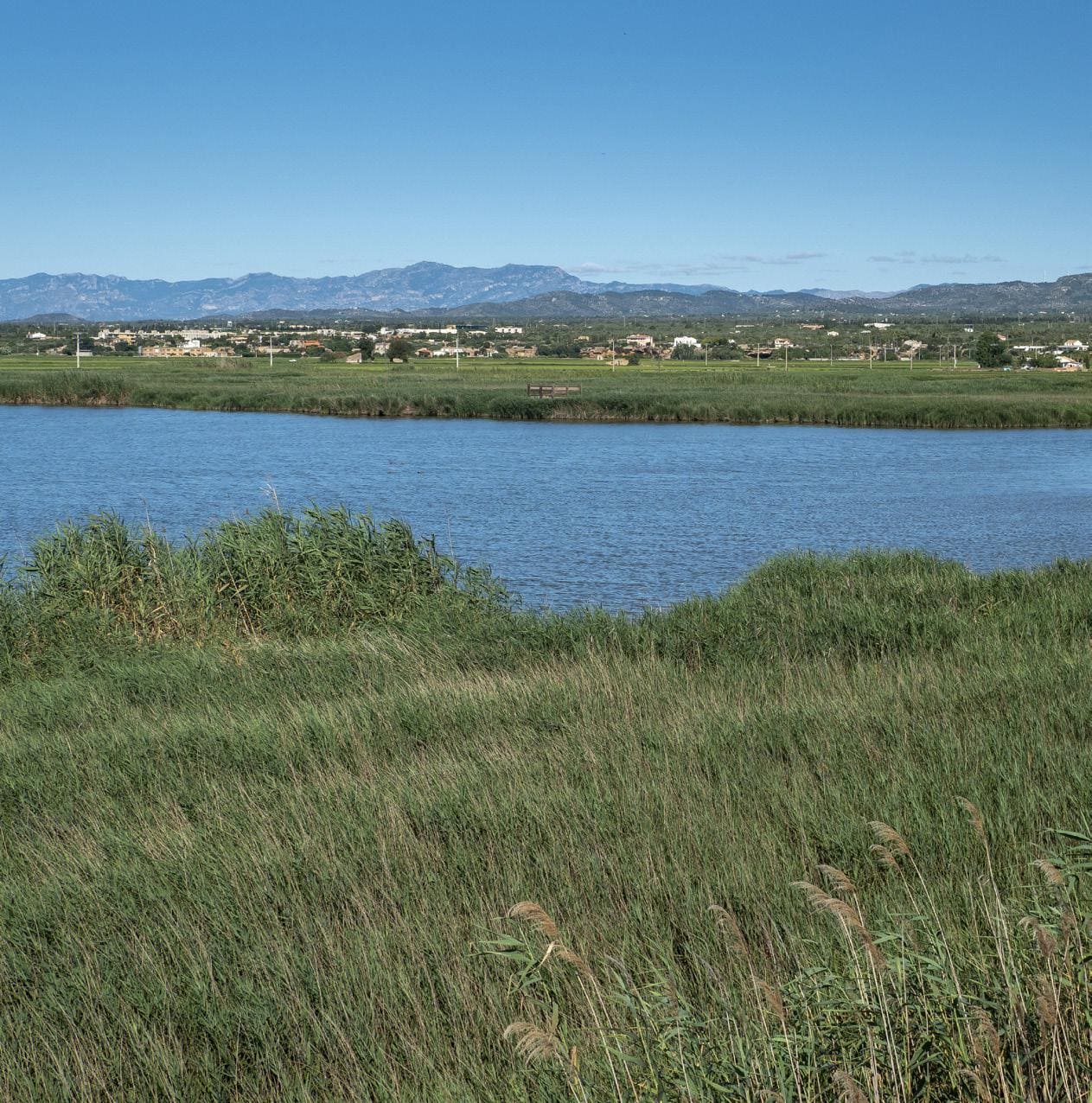
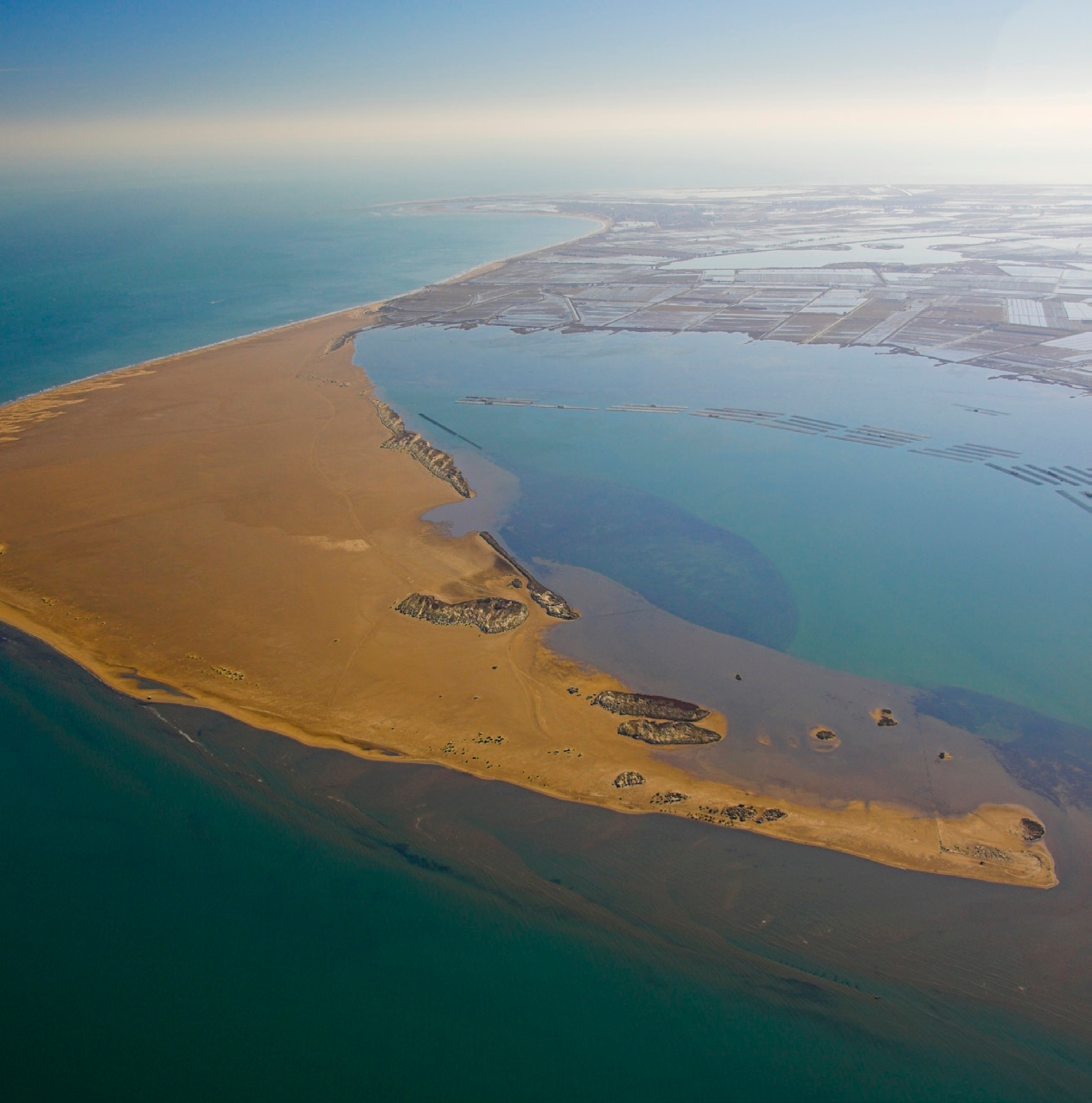
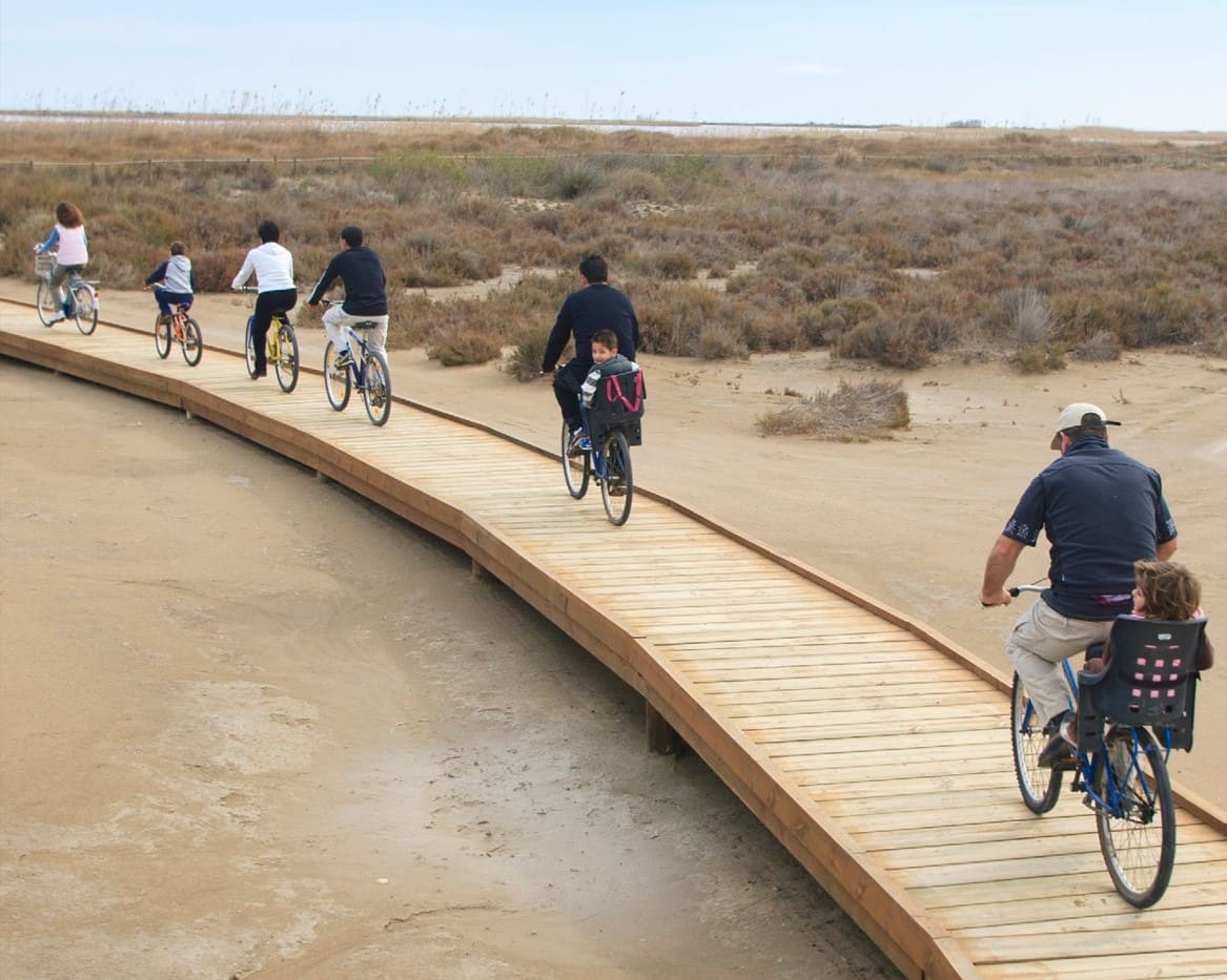
From Amposta onwards, the route definitively leaves the former railway corridor and descends towards the sea along a cycle path running parallel to the TV-3408 road, heading towards the Alfacs Bay. The final kilometres cross rice fields and open spaces within the Ebro Delta Natural Park, culminating in La Ràpita by the sea, thus completing a journey that connects mountains, river and Mediterranean within a single cycle touring experience.
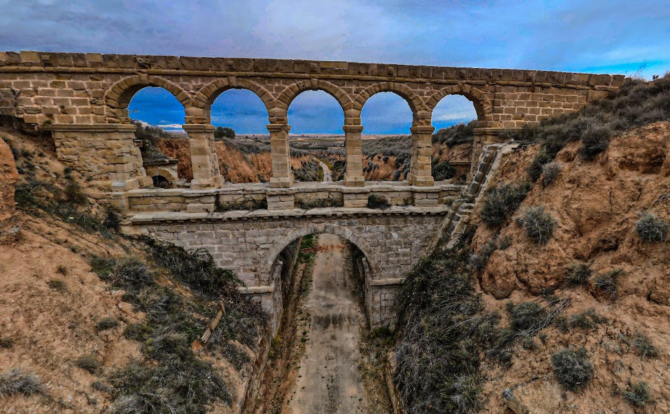
La Torica Aqueduct
Old railway aqueduct on the Val de Zafán line that allowed small ravines to be crossed, today integrated into the greenway as a unique element of historical engineering.
Algars Viaduct
Impressive metal bridge on the old Val de Zafán line that crosses the Algars River, marking the boundary between Aragon and Catalonia and offering one of the most emblematic panoramas of the greenway.
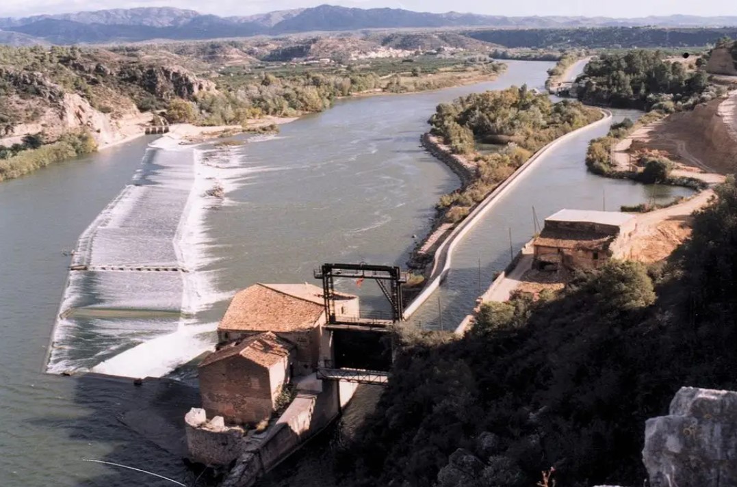
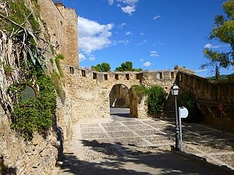
Viewpoint of the Assut de Xerta
High point with privileged views over the dam and the course of the Ebro, a key space for understanding the historical irrigation system of the territory.
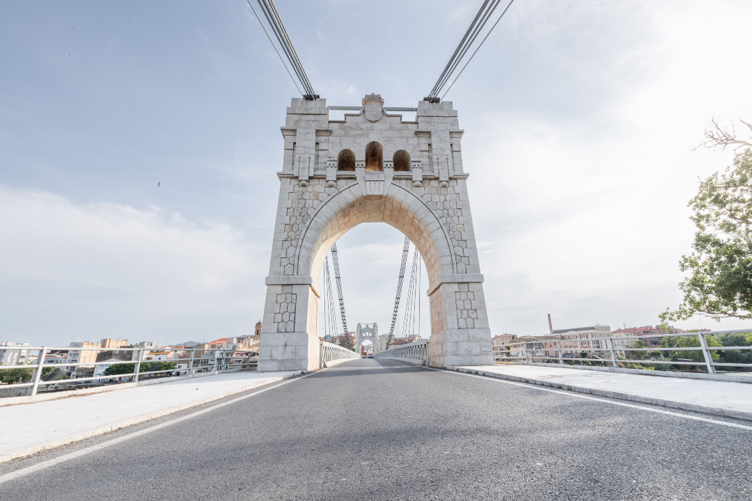
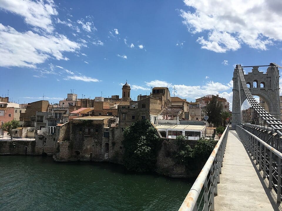
Red Bridge of Tortosa
The old railway bridge over the Ebro is a bridge in the city of Tortosa (Baix Ebre) protected as a cultural asset of local interest. It is currently used as a pedestrian viaduct.
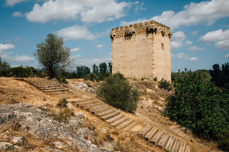
Torre de la Carrova
The Torre de la Carrova is a medieval watchtower from the 14th century located on the banks of the Ebro, restored and a testament to the territory's river defense system.
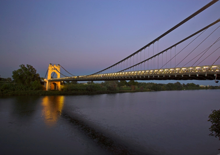
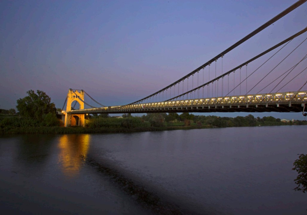
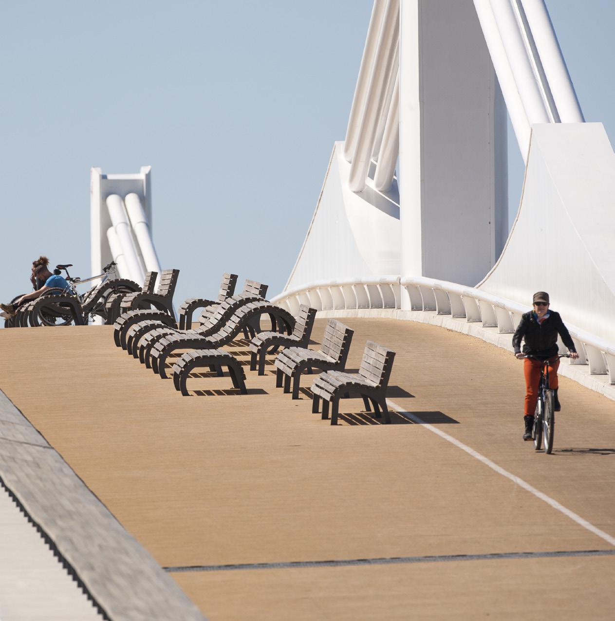
Amposta Suspension Bridge
From the River Walk you can see the Ebro River passing through Amposta and the impressive Suspension Bridge, inaugurated in 1920. The boat crossing was the traditional historical way of crossing the Ebro River.
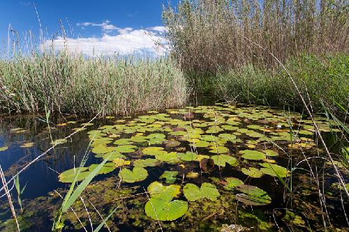
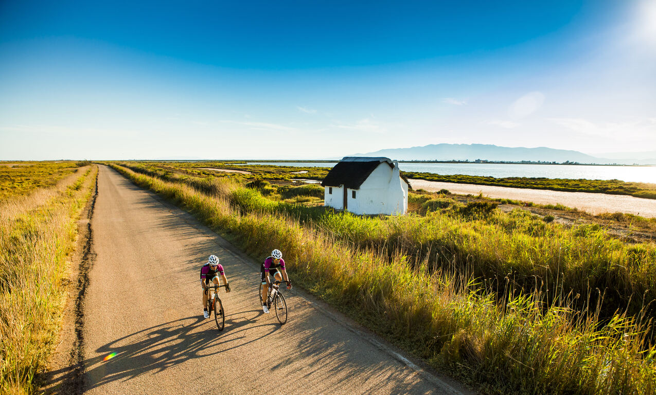
Ullals de Baltasar
Surrounded by rice fields, these freshwater springs from the Montsià and Ports mountains offer shady areas and characteristic flora and fauna.
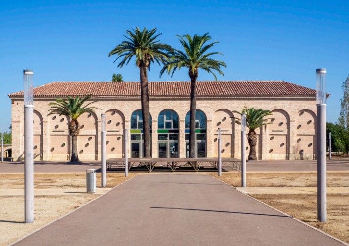
Ebro Sea Museum
This 19th century building was the offices and workshops of the Amposta to La Ràpita navigation channel. Today it is a museum space for the appreciation of the rich natural and cultural heritage of the Mediterranean.
Tips
- You must wear a helmet and bring food and enough water. Carry your phone and keep it charged; in case of emergency, call 112. Depending on the season, it is advisable to bring sunscreen and insect repellent.
- The terrain is completely flat, but be aware of the prevailing winds in the area.
- Check the weather forecast before heading out at meteo.cat
- It is advisable to carry puncture repair equipment.
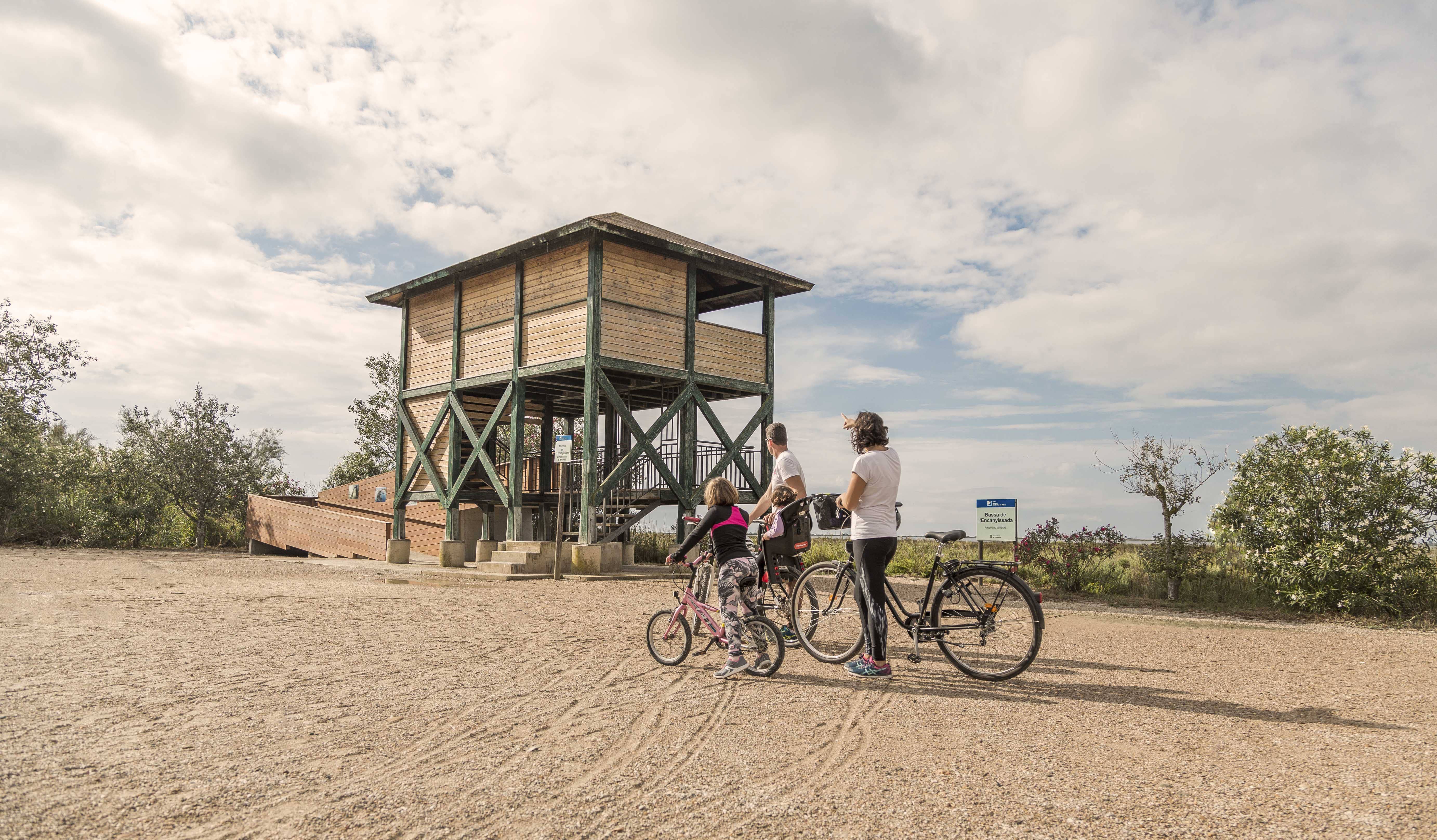
- Make use of the viewpoints, they will show you the delta landscape. Bring binoculars to watch the birds.
Amposta is a Spanish municipality and town in the province of Tarragona, in the autonomous community of Catalonia. It is the capital of the Montsià region. Located at an altitude of 8 m above sea level, on the banks of the Ebro River, the municipality has a population of 22,637 (INE 2024). Its economic activity is mainly agriculture (rice farming) and services. In the final years of the 20th century, a small but important industrial sector emerged based on the food, paper and packaging industries, furniture, and a multitude of small machinery workshops. In addition to the city of Amposta, the municipality includes the town of Poblenou del Delta and part of Balada.
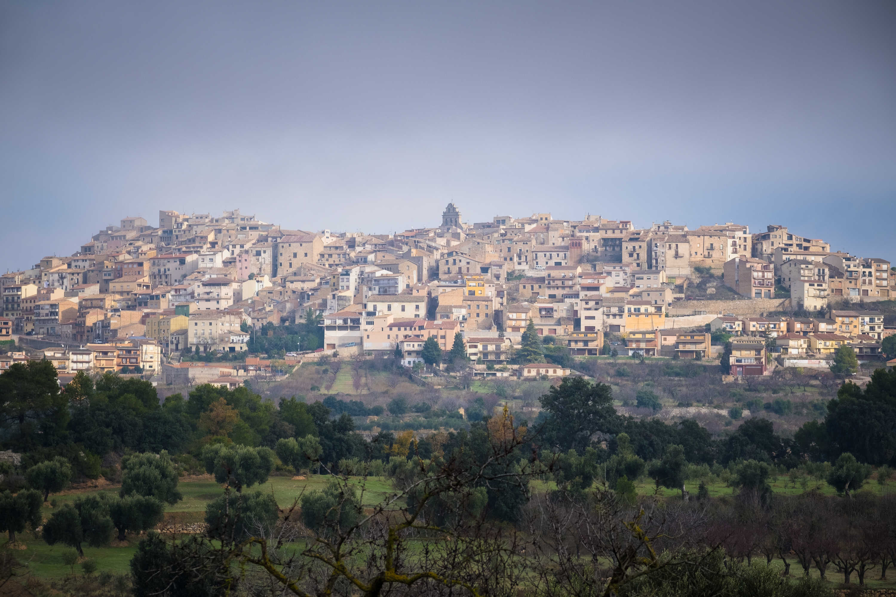
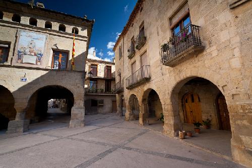
Horta de Sant Joan awaits you with its purest essence: a stone-built village surrounded by the magic of the Ports mountains. Walking through its medieval streets, you’ll discover calm, history and authenticity. Enjoy the landscapes that inspired Picasso, nature trails and a cuisine that truly captivates. A peaceful destination, full of light and character.
La Ràpita, located on the Montsià coast, is a charming fishing town known for its harbour, beaches and fresh fish market. Local cuisine stands out for its rice dishes and seafood, reflecting the area’s strong fishing tradition. The surrounding area offers flat, peaceful paths ideal for cycling routes, allowing visitors to explore the delta’s rice fields, nearby natural spaces and the beauty of the coastline, combining nature, culture and sport in a truly Mediterranean setting.
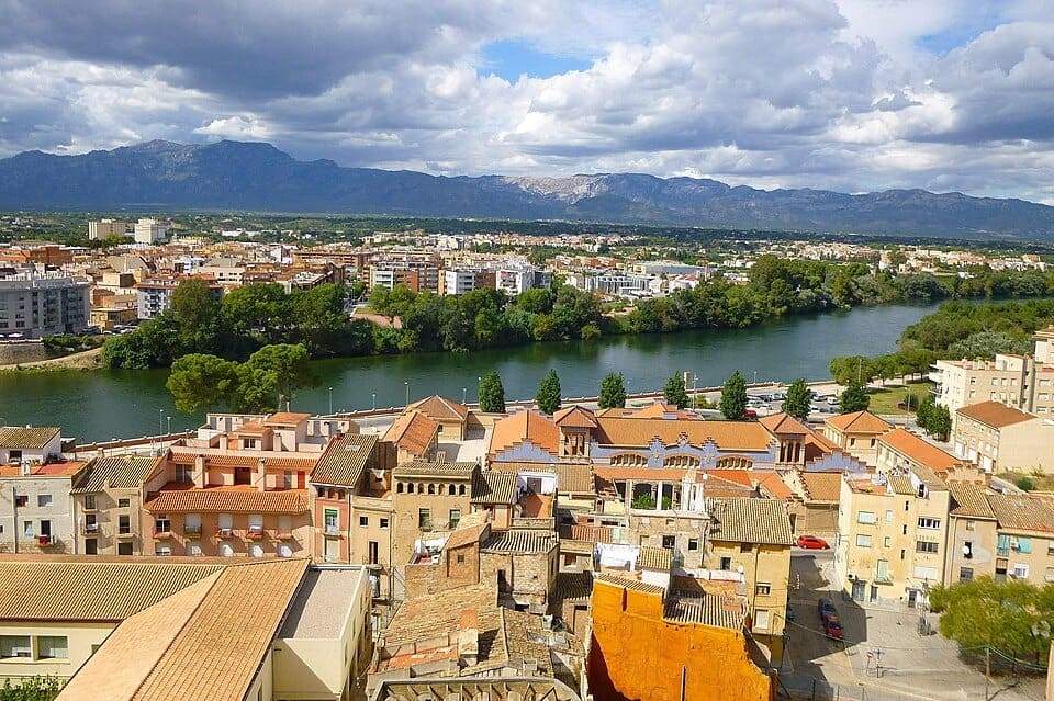
Tortosa, capital històrica de les Terres de l’Ebre, és una ciutat amb un ric patrimoni que conserva l’empremta de diverses cultures, amb la imponent catedral de Santa Maria, el castell de la Suda i els carrers del nucli antic com a principals referents. Travessada pel riu Ebre, combina l’encant del seu llegat arquitectònic amb una vida cultural activa i una gastronomia marcada pels productes de l’horta i del riu. Des d’aquí surten rutes ciclistes que permeten recórrer la Via Verda de la Val de Zafán o explorar els paisatges de l’Ebre i els Ports, convertint Tortosa en un punt de partida perfecte per combinar cultura, natura i esport.
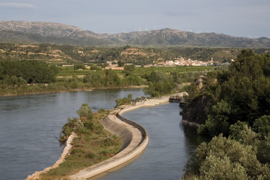
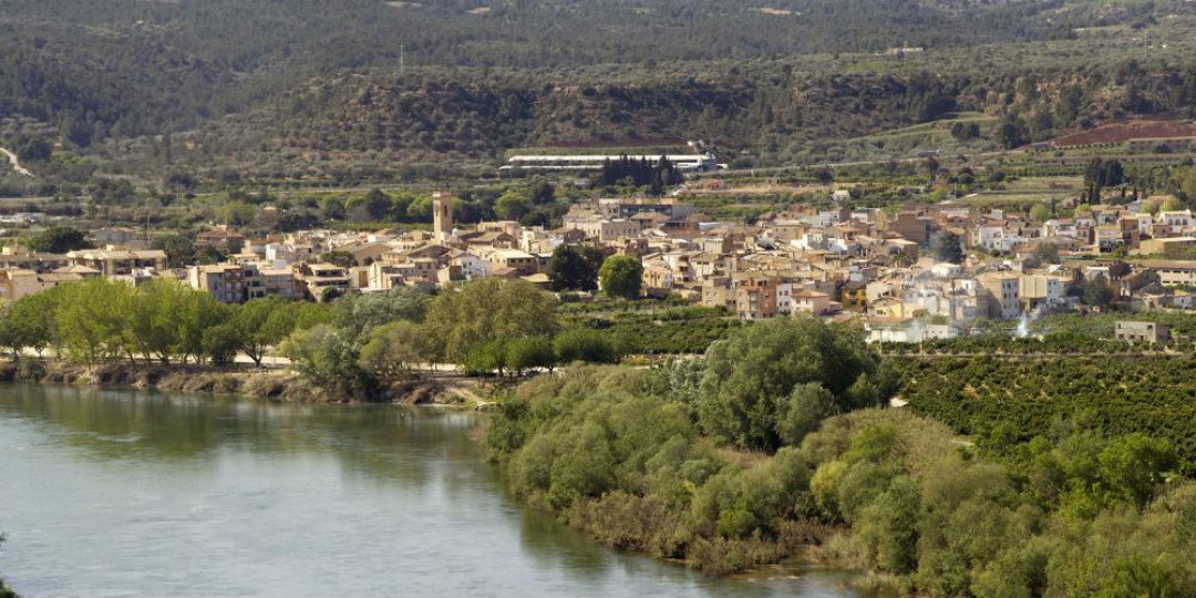
Xerta lies beside the Ebro, shaped by a long-standing and close relationship with the river. Along the Greenway stands the Assut of Xerta, a unique historic weir that is both a landscape landmark and part of the area’s heritage. Orchards, water and calm define a stretch that encourages slow cycling and following the river’s rhythm.
- As this is a linear route with various parking options along the way, you can adapt the itinerary to suit your needs and abilities.
- Please respect the signage and no-access zones.
- Lighting fires is strictly forbidden.
- Please respect the flora, fauna and environment. Collecting animal or plant species, whether alive or dead, is not permitted.
- Camping is only permitted at established campsites.
- In protected areas, dogs must be kept on a lead.
The take-off and landing of drones is forbidden. - Littering is forbidden except in designated areas.
THE ZAFÁN GREENWAY GAME
Explore, learn, and have fun with Antoni and Clara as you travel the routes of the Zafán Valley. Each stop is a new adventure, every challenge a story waiting for you!
Comença a jugar!Along your route, you'll find challenges and activities to earn points, solve clues, or win virtual prizes.
Join our games and become an expert on the Zafán Greenway.
Available games (2)
Observe birds
Find the bird-watching spot along the route, scan the QR code, and answer three questions to earn your badge.
More informationPhotograph shells
Upload a photo to Instagram of the shells you find on the beach using the hashtag #conchasdelFalgar
More information
Other routes you may like...
La Ràpita - Amposta - L'Aldea - Camarles - L'Ampolla (Porta del Delta)