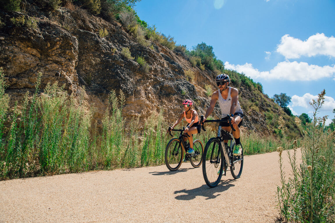
La Ràpita - Amposta - L'Aldea - Camarles - L'Ampolla (Porta del Delta)
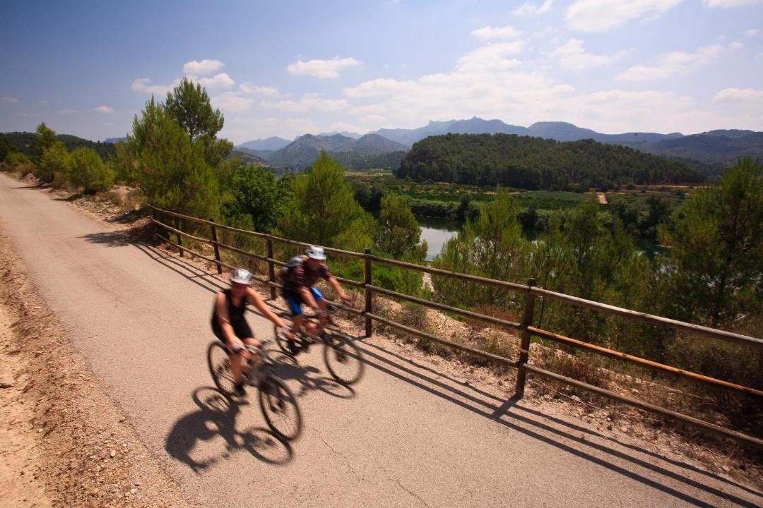
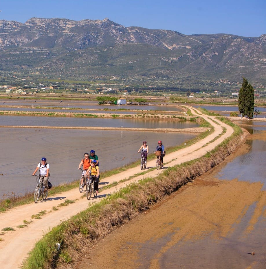
Cycling route through the Ebro Delta Natural Park
Route characteristics
- 31,86 km
- 76 m
- 15 m
- -5 m
With traffic Motorized vehicles are frequent.
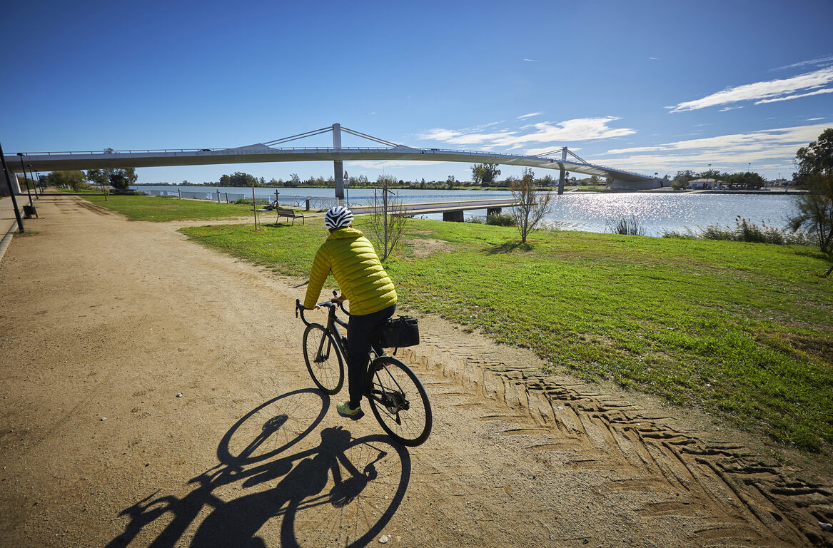
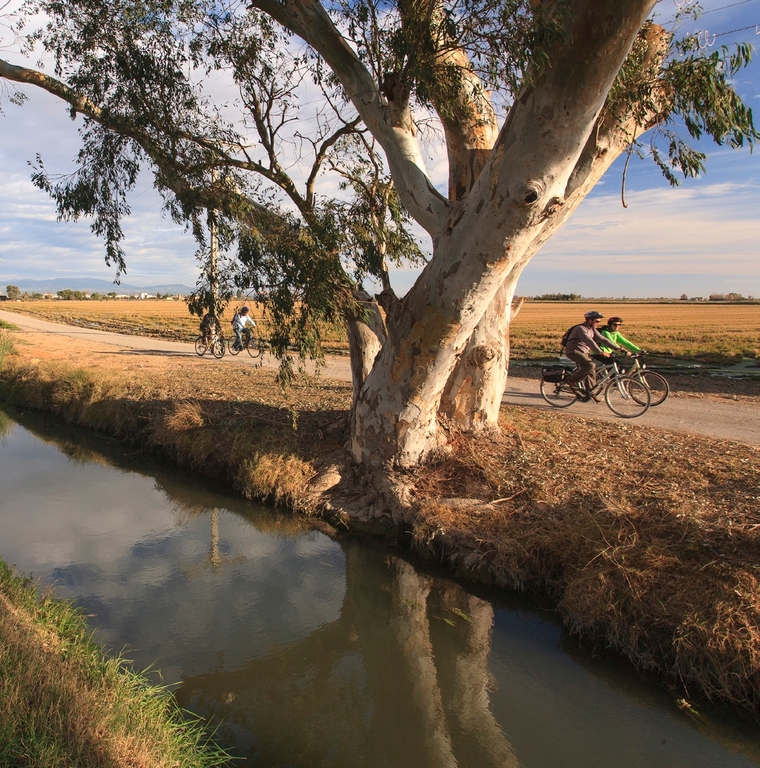
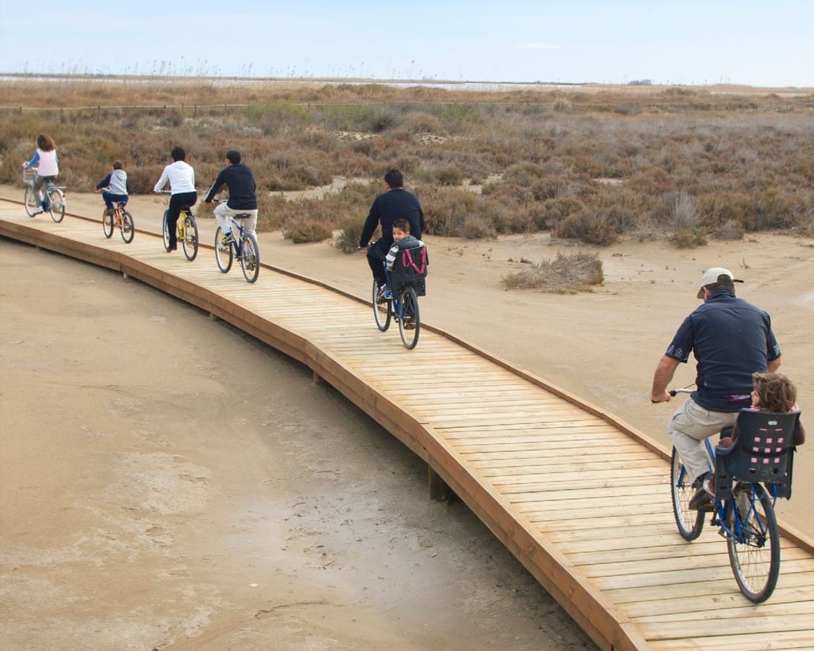
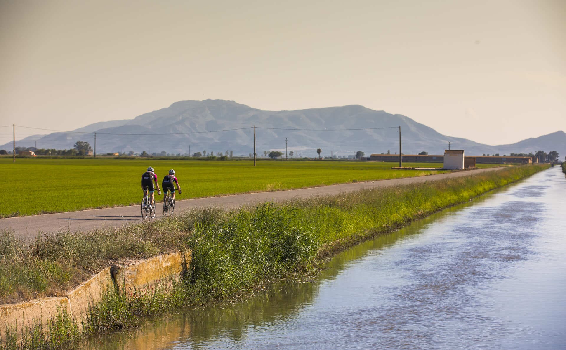
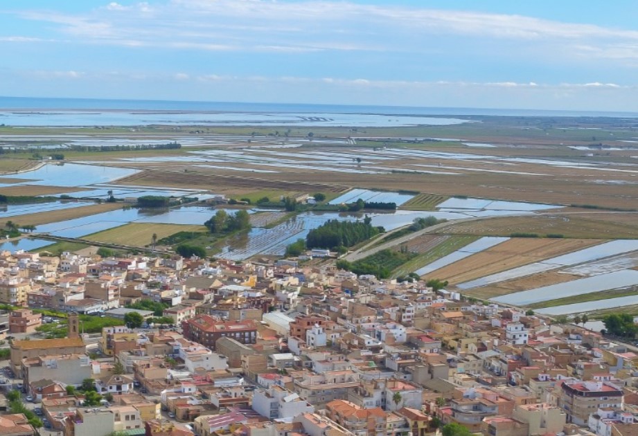
The itinerary begins at the Tourist Office of La Ràpita and passes through some of the most representative areas of the Ebro Delta, ending in L’Ampolla. From the starting point in Sant Carles de la Ràpita, the route invites you to explore the natural and cultural heritage of the territory, with the first stop at the Tourist Office itself, a hub of information and a gateway to the experiences of the municipality and the Ebro Delta Natural Park.
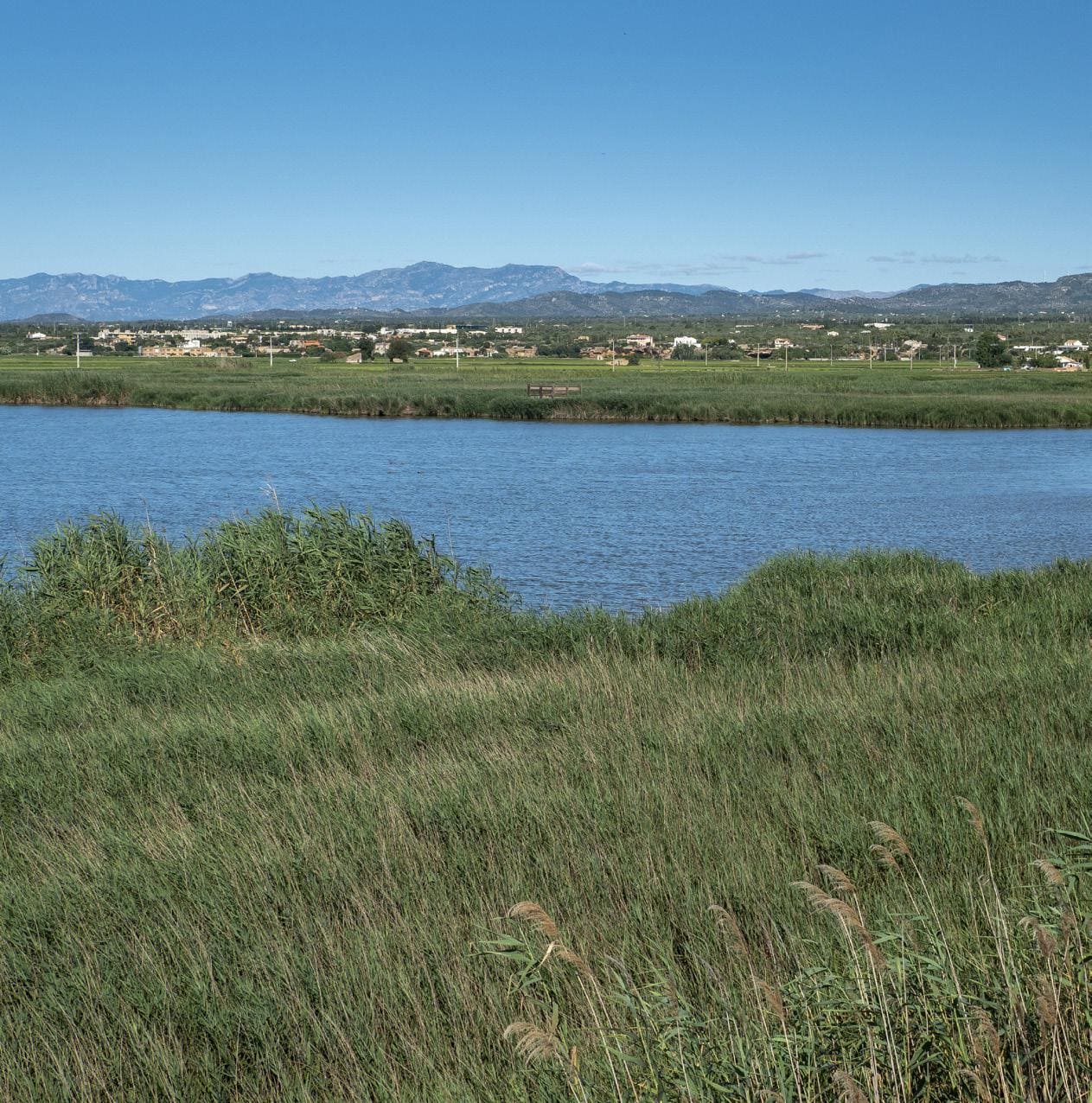
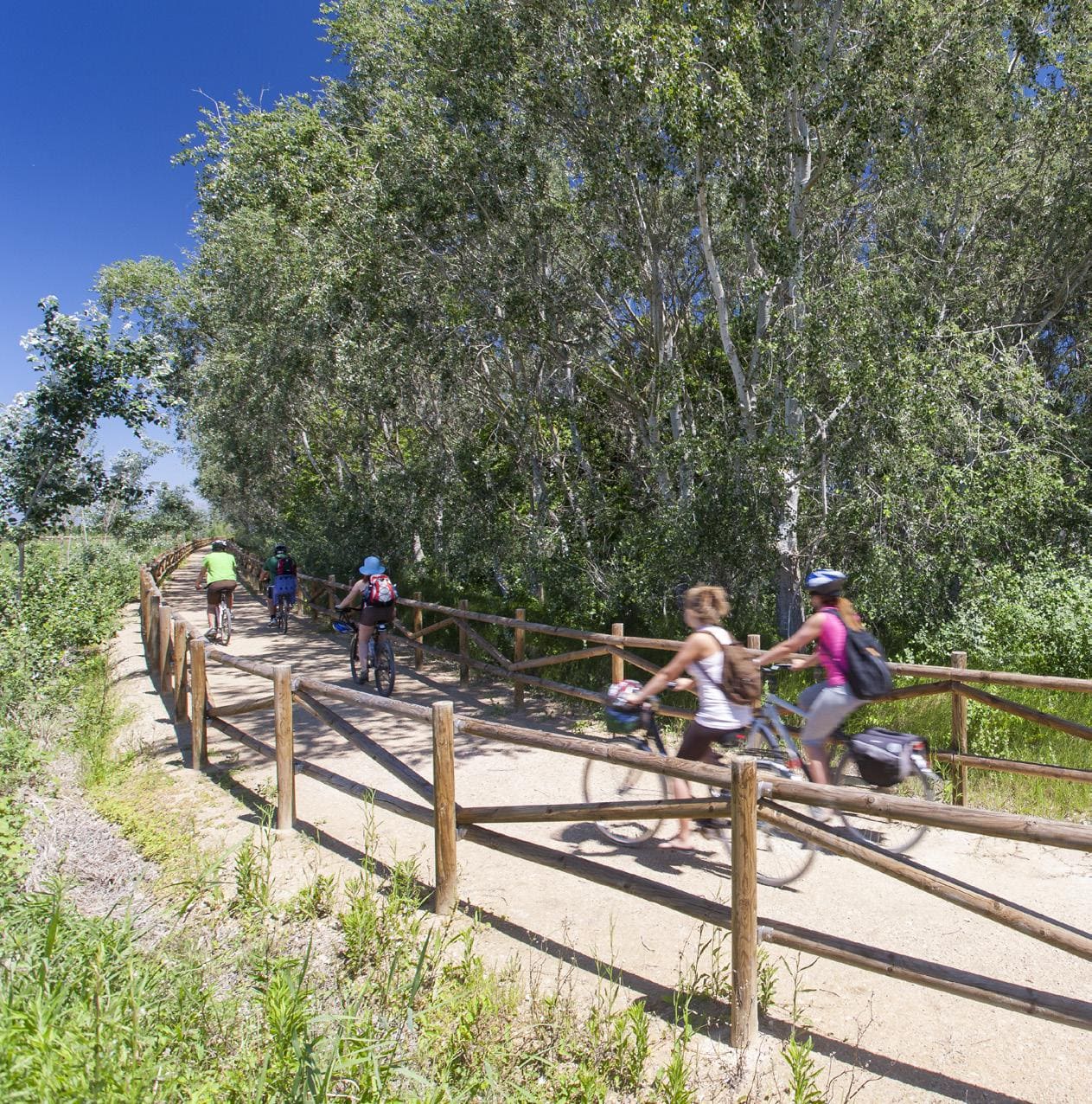
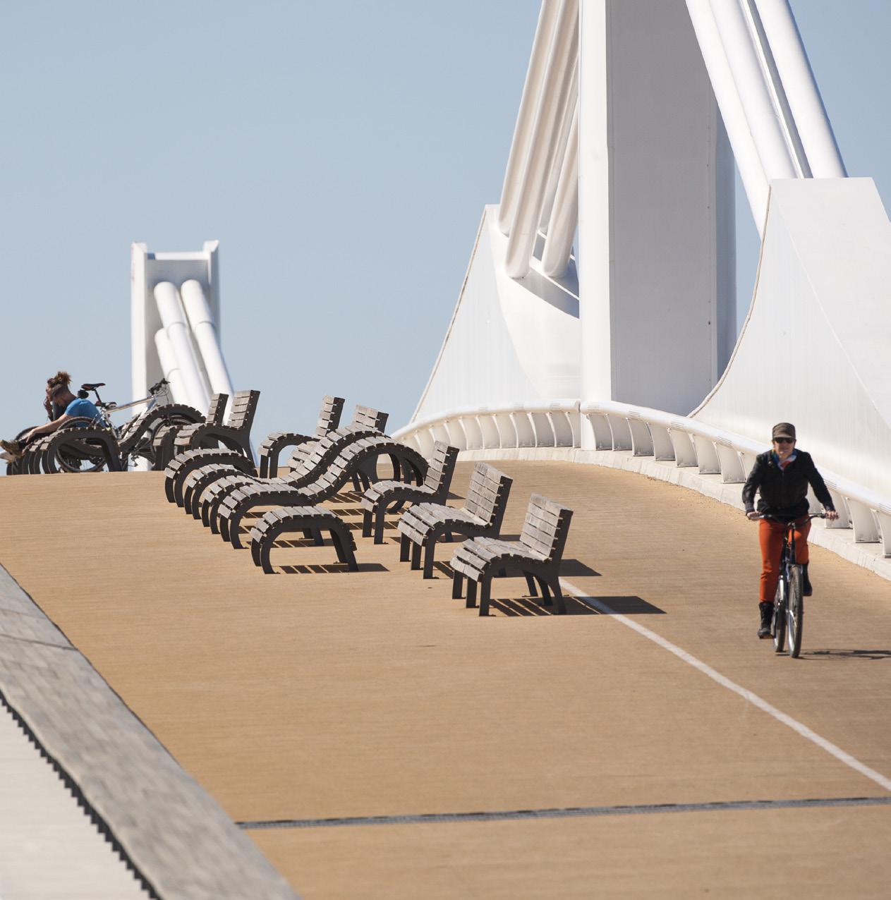
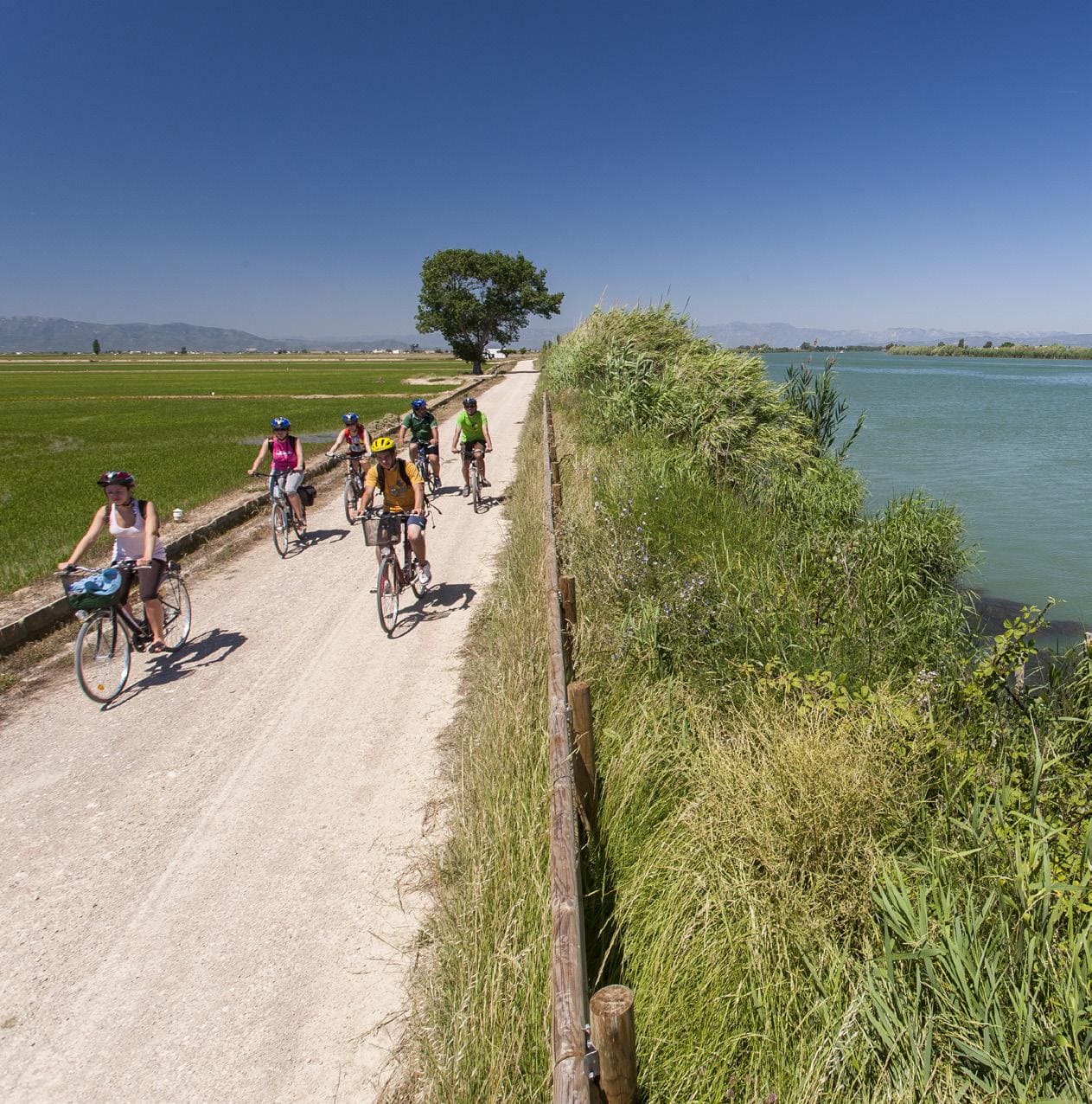
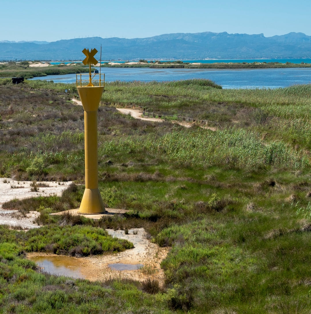
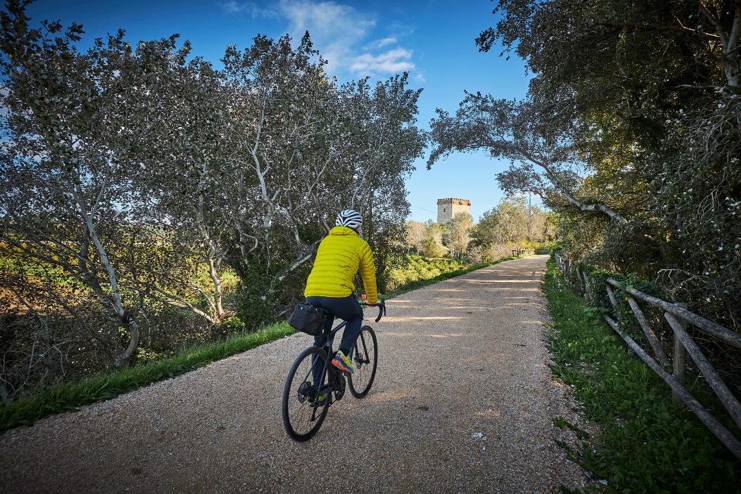
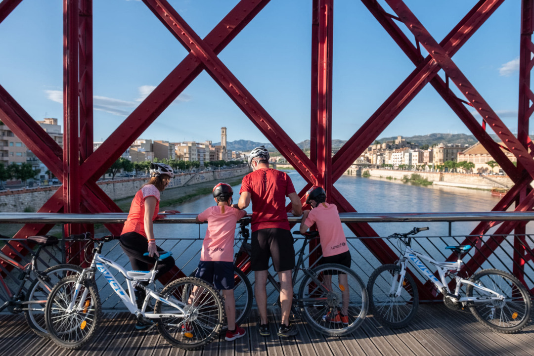
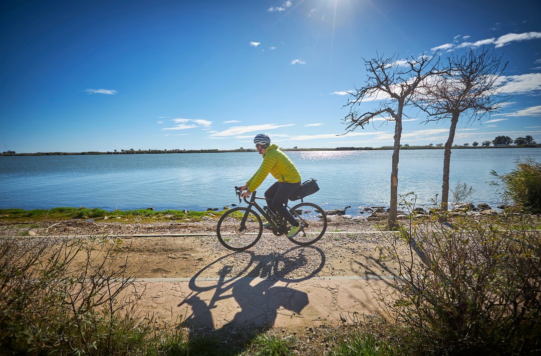
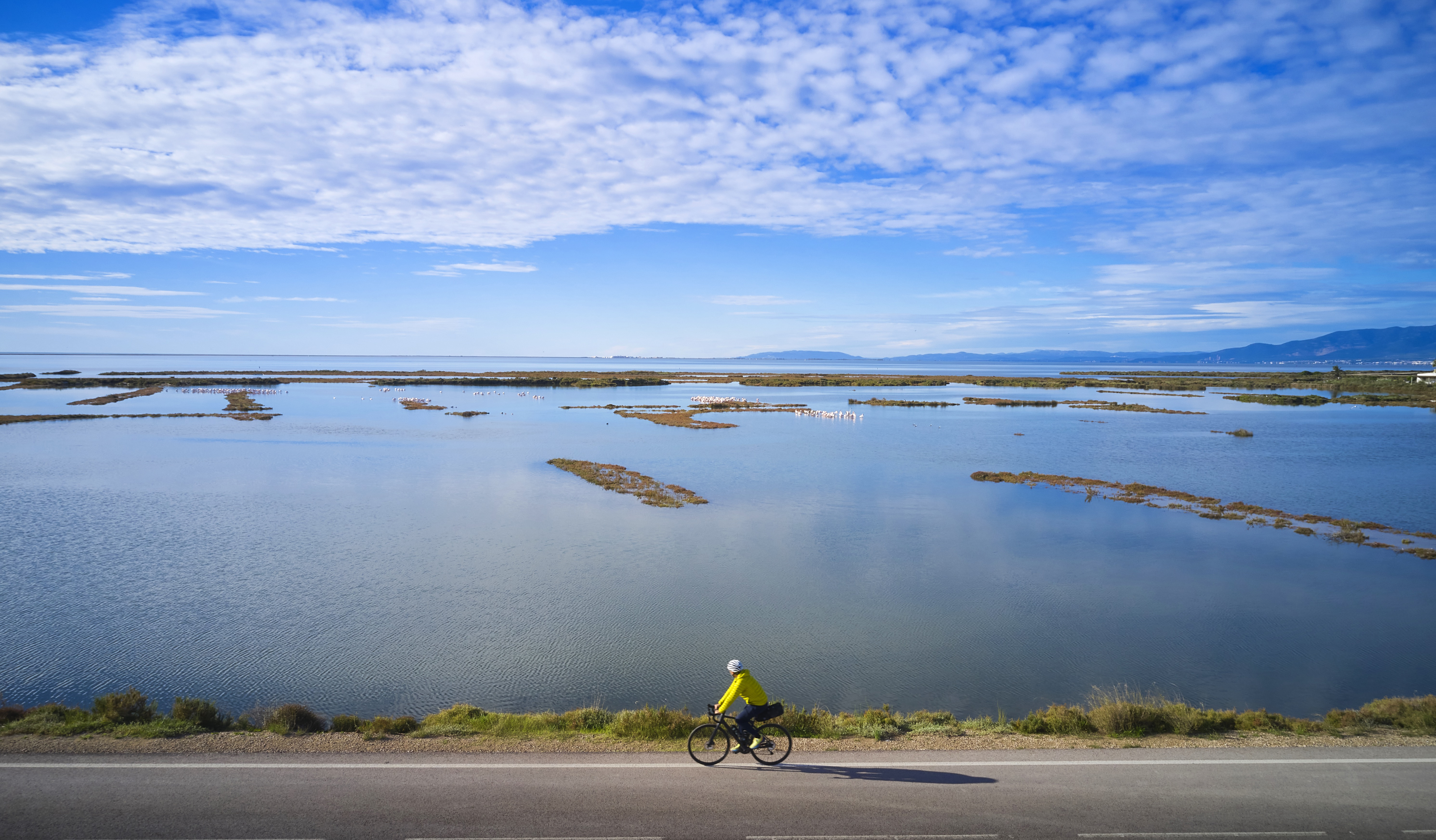
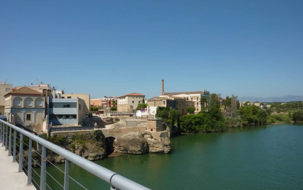
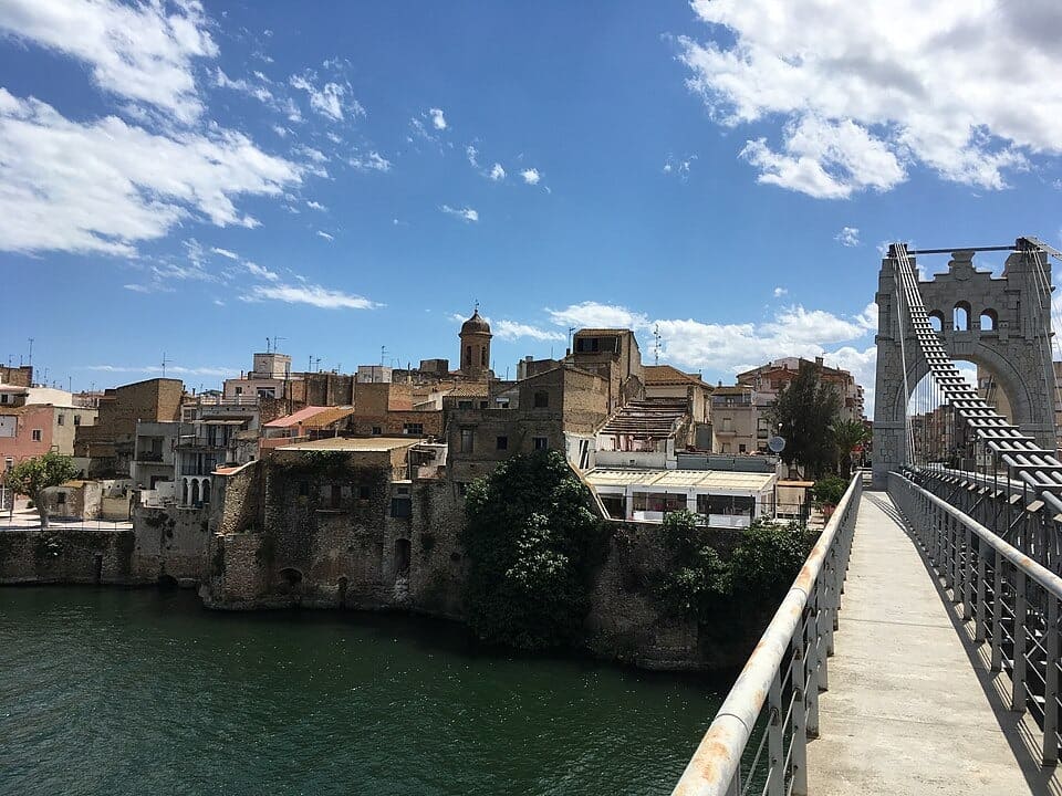
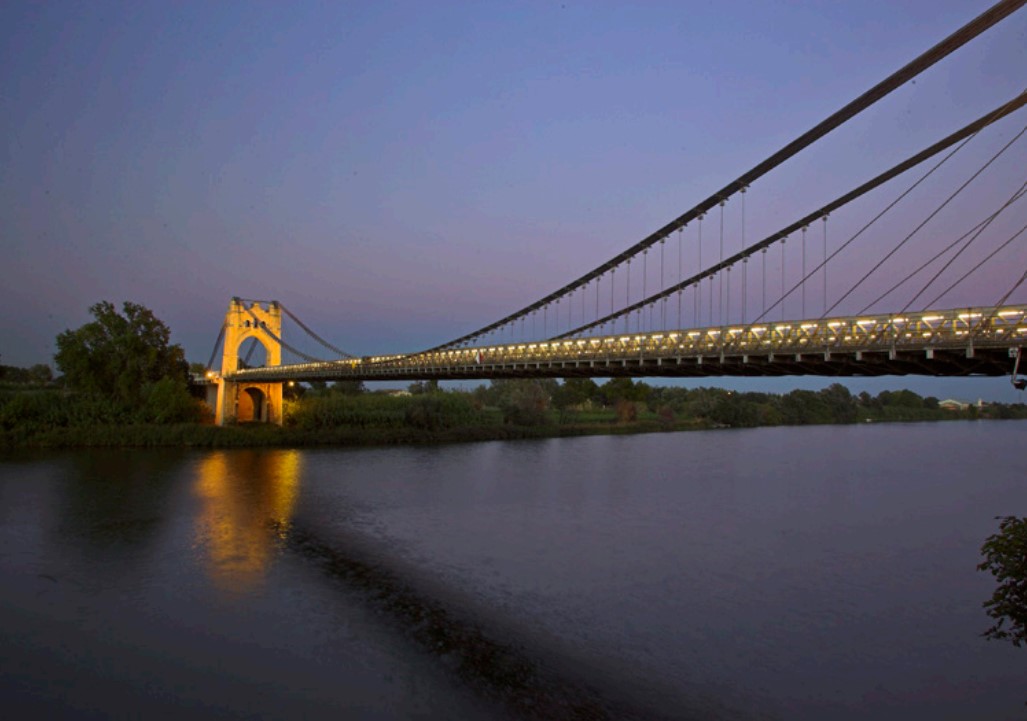
The route continues to the Ullals de Baltasar, freshwater springs surrounded by rice fields that create a cool, shaded area with unique flora and fauna. From here, the itinerary heads inland to the Pont Penjant d’Amposta, an iconic suspension bridge inaugurated in 1920, offering views of the majestic flow of the Ebro River and recalling the old ferry crossing that for centuries connected the two riverbanks.
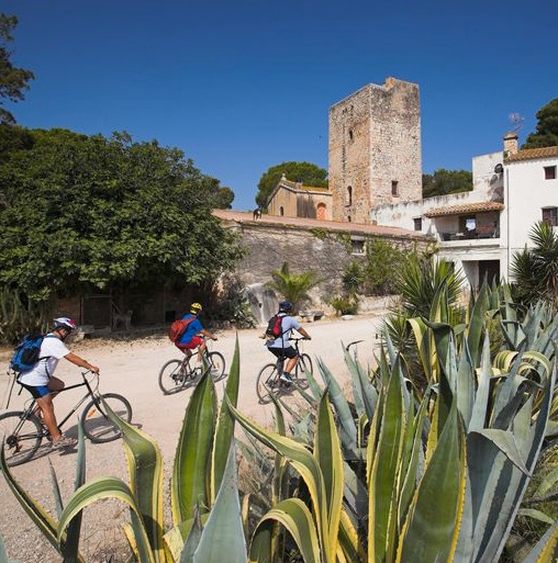
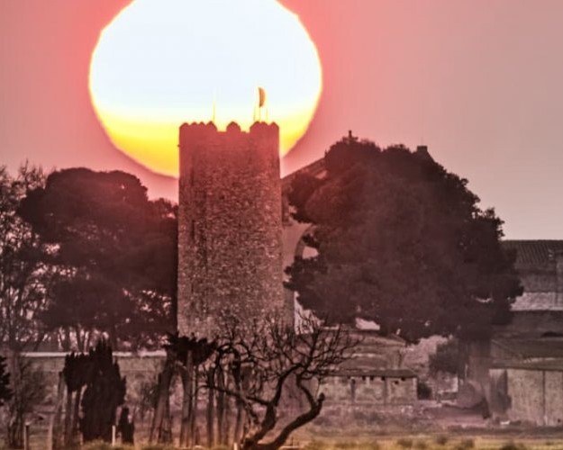
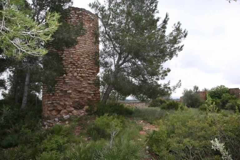
The journey proceeds to the Ermita de la Aldea, a medieval heritage complex with a watchtower and castle remains, bearing witness to the territory’s defensive history. Further along, the Torre de Camarles evokes a past marked by vigilance against Mediterranean piracy, rising above the remains of an old Islamic farmhouse.
Finally, the itinerary reaches the Tourist Office of L’Ampolla, the end point of the route and a welcoming space to continue discovering the natural, scenic, and gastronomic attractions of this coastal town. This route provides a complete overview of the Delta, combining nature, history, and identity in a landscape shaped by water and the passage of time.
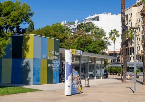
La Ràpita Tourist Office
Tourist information center and reservation of tourist packages and activities, in La Ràpita and the surroundings of the Ebro Delta Natural Park.
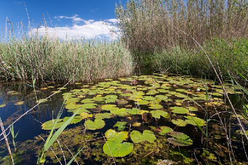
Ullals de Baltasar
Surrounded by rice fields, these freshwater springs from the Montsià and Ports mountains offer shady areas and characteristic flora and fauna.
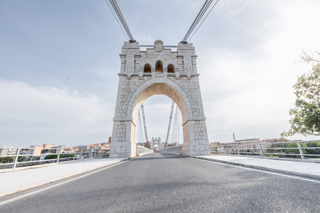
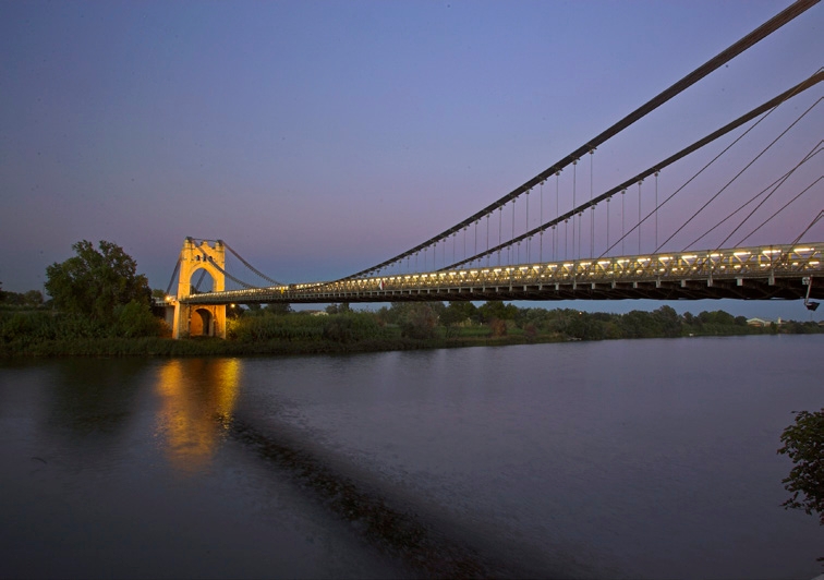
Amposta Suspension Bridge
From the River Walk you can see the Ebro River passing through Amposta and the impressive Suspension Bridge, inaugurated in 1920. The boat crossing was the traditional historical way of crossing the Ebro River.
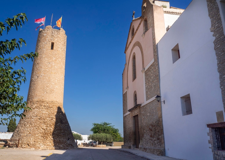
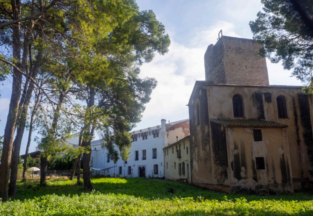
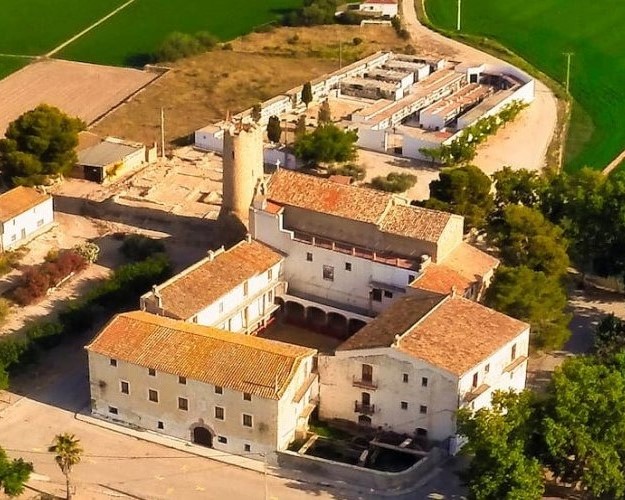
Hermitage of the Village
Heritage complex formed by the church and a 20-meter tower of medieval origin, with the remains of a castle at its foot. The tower houses the watchtowers interpretation center.
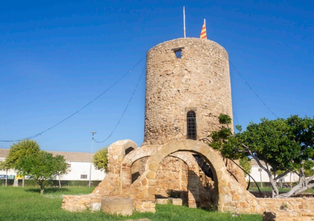
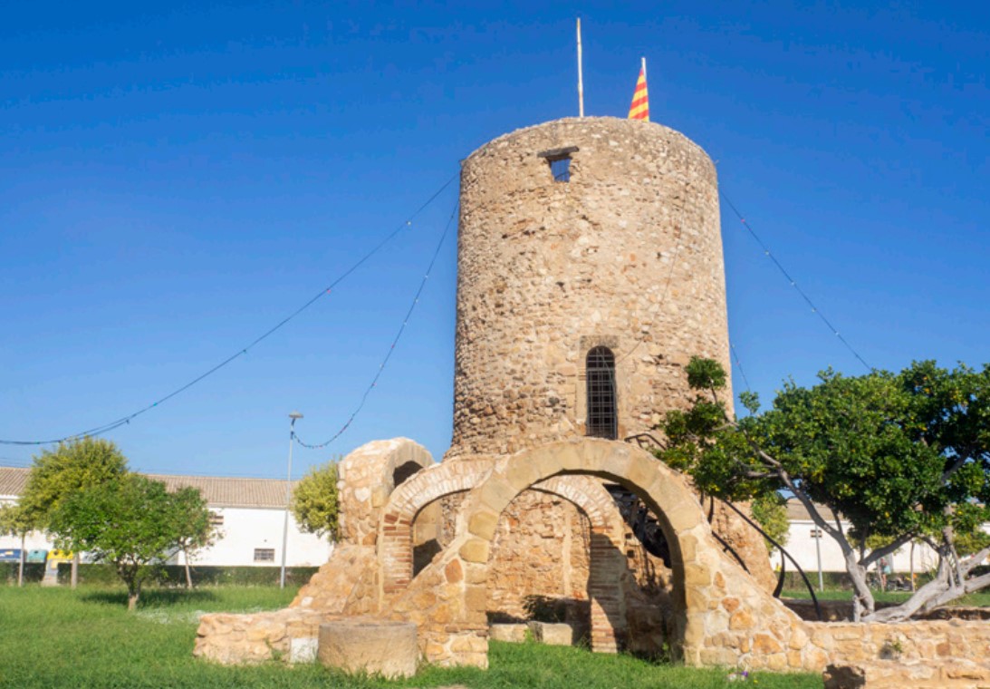
Camarles Tower
Remains of an old medieval castle, built on an old Islamic farmhouse. From the 16th century, Mediterranean piracy turned these towers into lookout points offshore.
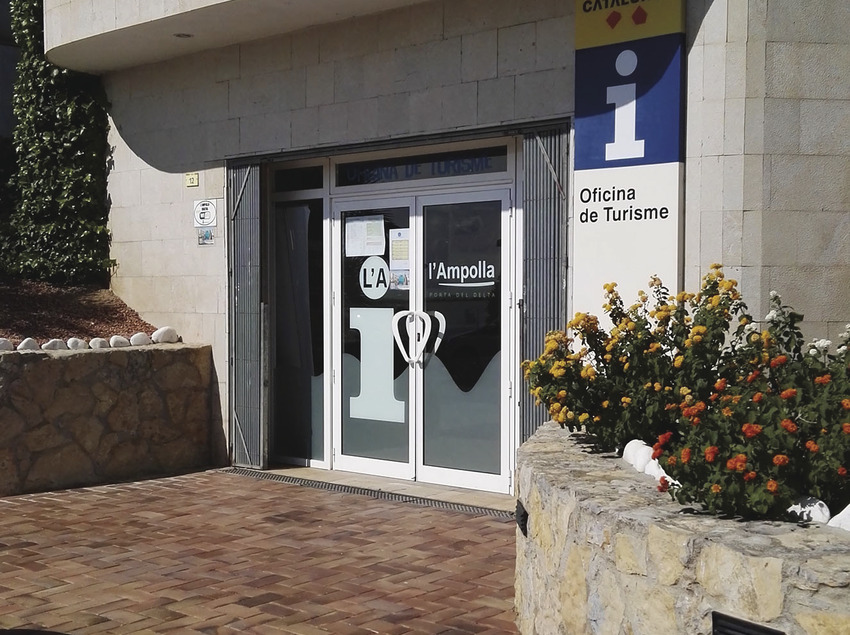
L'Ampolla Tourism Office
The l'Ampolla Tourist Office offers information and advice to discover the natural, gastronomic and cultural attractions of the municipality and its surroundings.
Tips
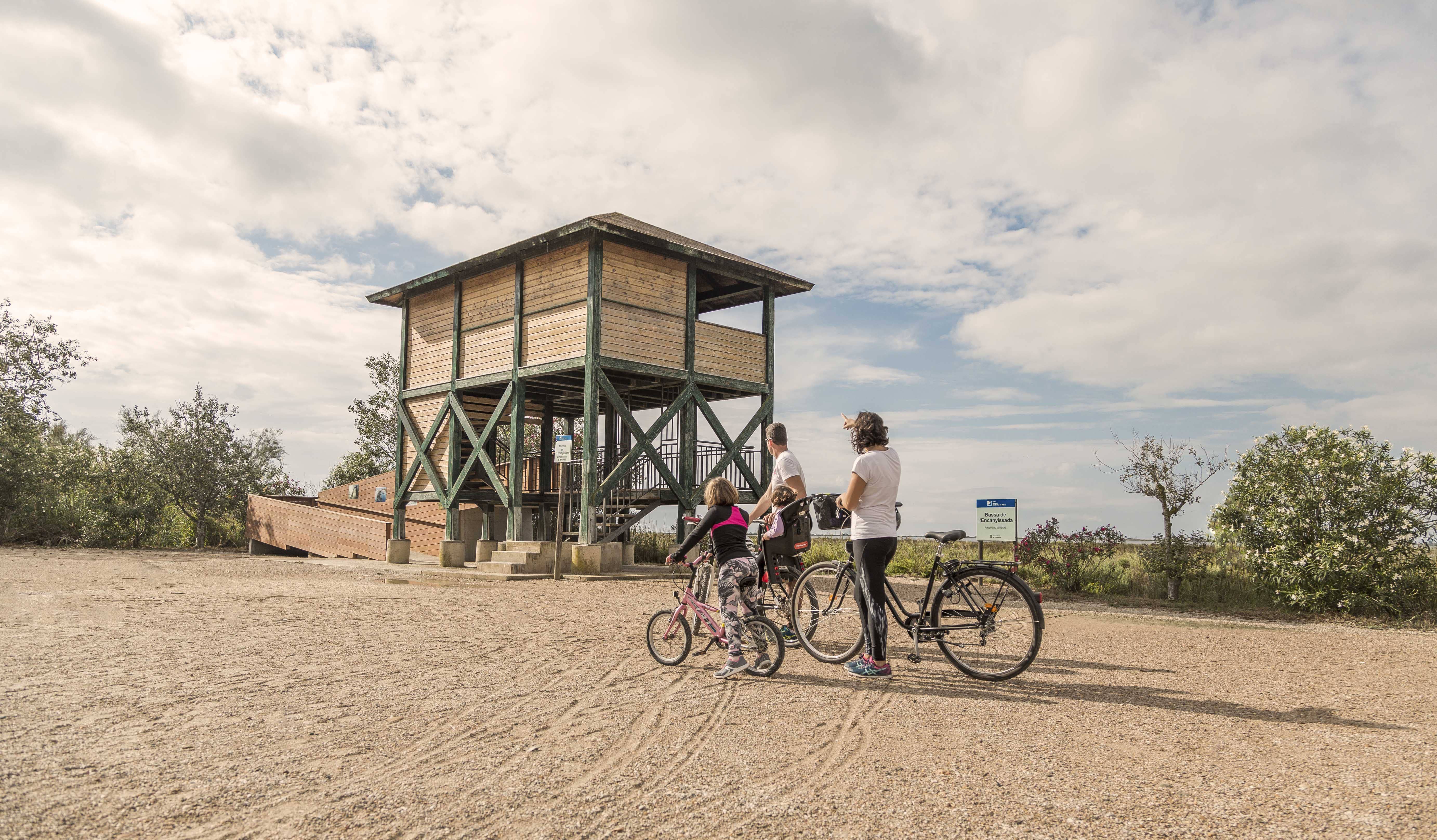
- Enter a natural area shared with an agricultural community and learn about the values of the area at the Park’s information centers: the Ecomuseum (tel. 977 489 679) and the Casa de Fusta (tel. 667 001 382).
- It is necessary to bring a helmet, food, and sufficient water. Carry your mobile phone and keep the battery charged; in case of emergency, call 112. Depending on the season, it is advisable to bring sunscreen and insect repellent.
- The terrain is completely flat, but pay attention to the usual winds in the area.
- Check the weather forecast before heading out at meteo.cat.
- It is recommended to carry materials for puncture repairs.
- Use the viewpoints to enjoy the delta landscape. Bring binoculars for birdwatching.
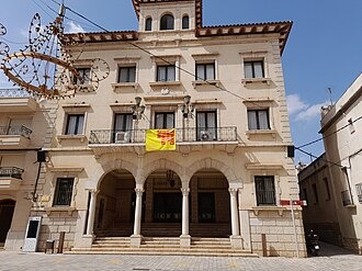
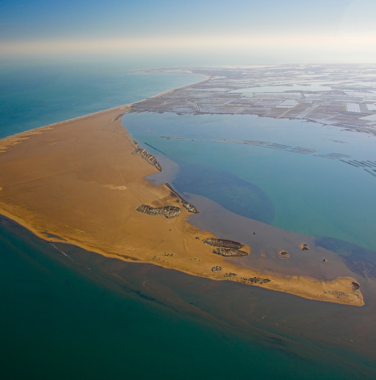
Amposta is a Spanish municipality and town in the province of Tarragona, in the autonomous community of Catalonia. It is the capital of the Montsià region. Located at an altitude of 8 m above sea level, on the banks of the Ebro River, the municipality has a population of 22,637 (INE 2024). Its economic activity is mainly agriculture (rice farming) and services. In the final years of the 20th century, a small but important industrial sector emerged based on the food, paper and packaging industries, furniture, and a multitude of small machinery workshops. In addition to the city of Amposta, the municipality includes the town of Poblenou del Delta and part of Balada.
Camarles, situat al cor del Delta de l’Ebre, és un municipi tranquil envoltat de camps d’arròs i canals que formen un paisatge únic i característic de la zona. Amb una vida local pausada i una gastronomia basada en productes del riu i de l’horta, ofereix un ambient autèntic i proper. Els camins plans que travessen els arrossars i connecten amb pobles veïns fan de Camarles un lloc ideal per a rutes ciclistes tranquil·les, cosa que permet gaudir de la natura, la fauna i l’essència del delta sense grans dificultats.
L’Aldea, situada al costat del riu Ebre, és un municipi amb un ambient tranquil i un entorn natural ric, envoltat de camps d’arròs i zones humides pròpies del Delta. La seva gastronomia, basada en l’arròs i el peix fresc, acompanya una vida local pausada i autèntica. Els camins plans i tranquils que envolten L’Aldea ofereixen rutes ideals per a ciclistes de tots els nivells, que permet descobrir el paisatge deltaic, la fauna i la tranquil·litat de la zona mentre es recorre el territori en bicicleta.
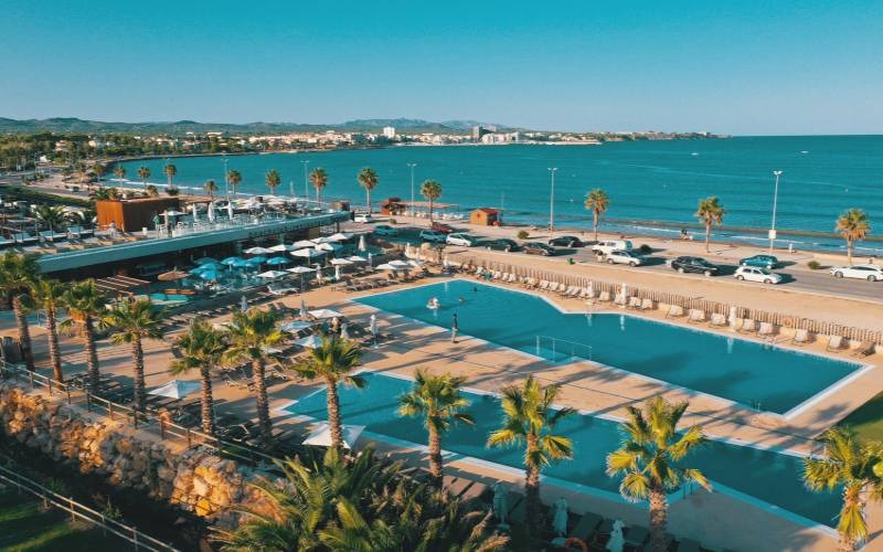
L’Ampolla, situat a la costa del Montsià, és un encantador poble mariner conegut per les seves platges i per ser la porta d’entrada al Parc Natural del Delta de l’Ebre. El poble conserva l’essència de la vida pesquera i ofereix una gastronomia centrada en el peix i el marisc fresc, amb mercats i restaurants que mostren la tradició local. Els voltants de L’Ampolla són ideals per descobrir en bicicleta, amb rutes planeres que recorren la costa, els arrossars i els camins del delta, i això permet gaudir del paisatge, la fauna i la tranquil·litat del territori.
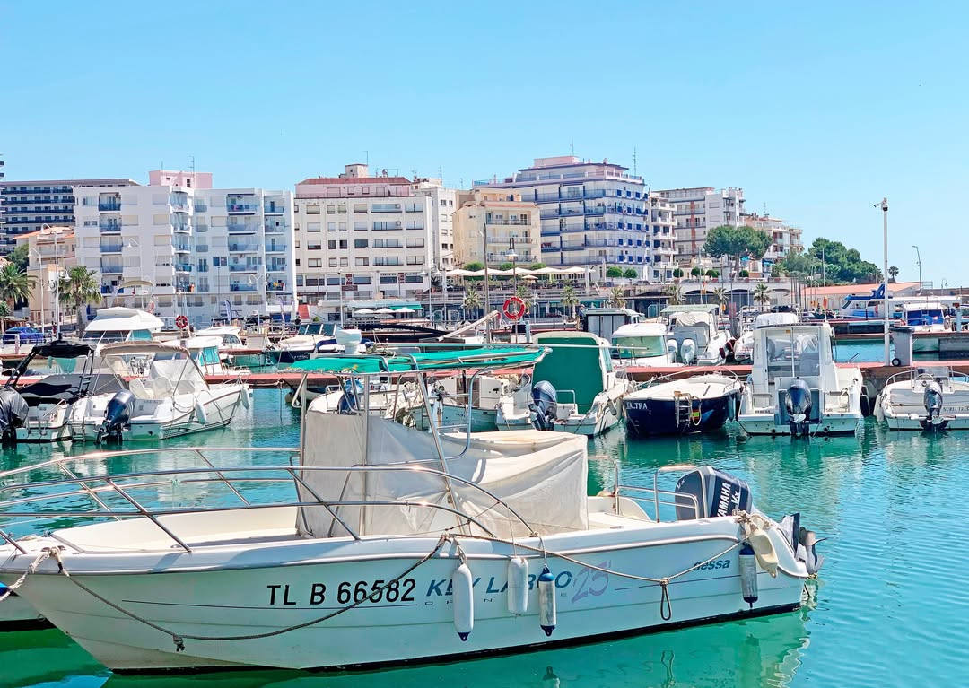
La Ràpita, located on the Montsià coast, is a charming fishing town known for its harbour, beaches and fresh fish market. Local cuisine stands out for its rice dishes and seafood, reflecting the area’s strong fishing tradition. The surrounding area offers flat, peaceful paths ideal for cycling routes, allowing visitors to explore the delta’s rice fields, nearby natural spaces and the beauty of the coastline, combining nature, culture and sport in a truly Mediterranean setting.
- As the route is linear and offers several options for parking vehicles along the way, you can adjust the itinerary according to your needs and abilities.
- Respect the signage and areas with restricted access.
- It is strictly forbidden to light fires.
- Respect the flora, fauna, and the environment. Collecting animal or plant species, whether alive or dead, is not allowed.
- Camping is only permitted in established campsites.
- In protected areas, it is forbidden to have dogs off-leash. Launching and landing drones is also prohibited.
- It is forbidden to leave trash, except in designated disposal areas.
THE ZAFÁN GREENWAY GAME
Explore, learn, and have fun with Antoni and Clara as you travel the routes of the Zafán Valley. Each stop is a new adventure, every challenge a story waiting for you!
Comença a jugar!Along your route, you'll find challenges and activities to earn points, solve clues, or win virtual prizes.
Join our games and become an expert on the Zafán Greenway.
Available games (2)
Observe birds
Find the bird-watching spot along the route, scan the QR code, and answer three questions to earn your badge.
More informationPhotograph shells
Upload a photo to Instagram of the shells you find on the beach using the hashtag #conchasdelFalgar
More information
Weather forecast
Today, Monday, Sant Carles de la Ràpita

Clear
3 km/h
29ºC max
25ºC min
No rain forecast
Next days forecast

Tuesday
32º max
23º min
Wednesday
30º max
24º min
Thursday
30º max
23º min
Friday
30º max
23º min
Other routes you may like...