Ecomuseum - Desembocadura
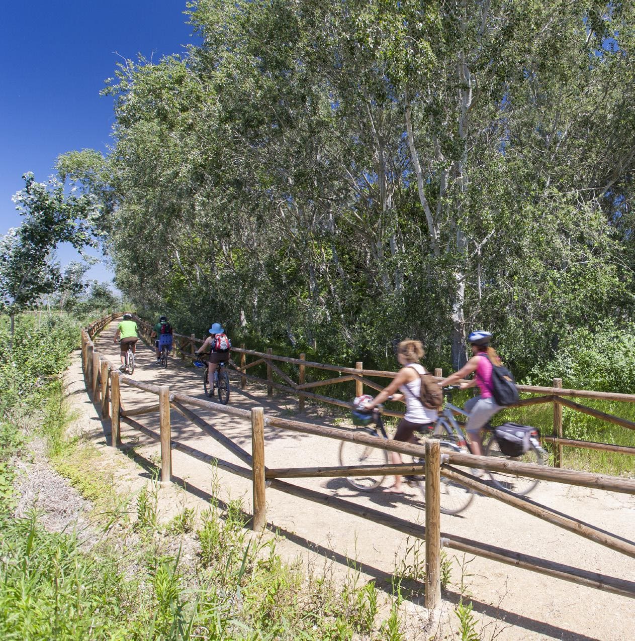
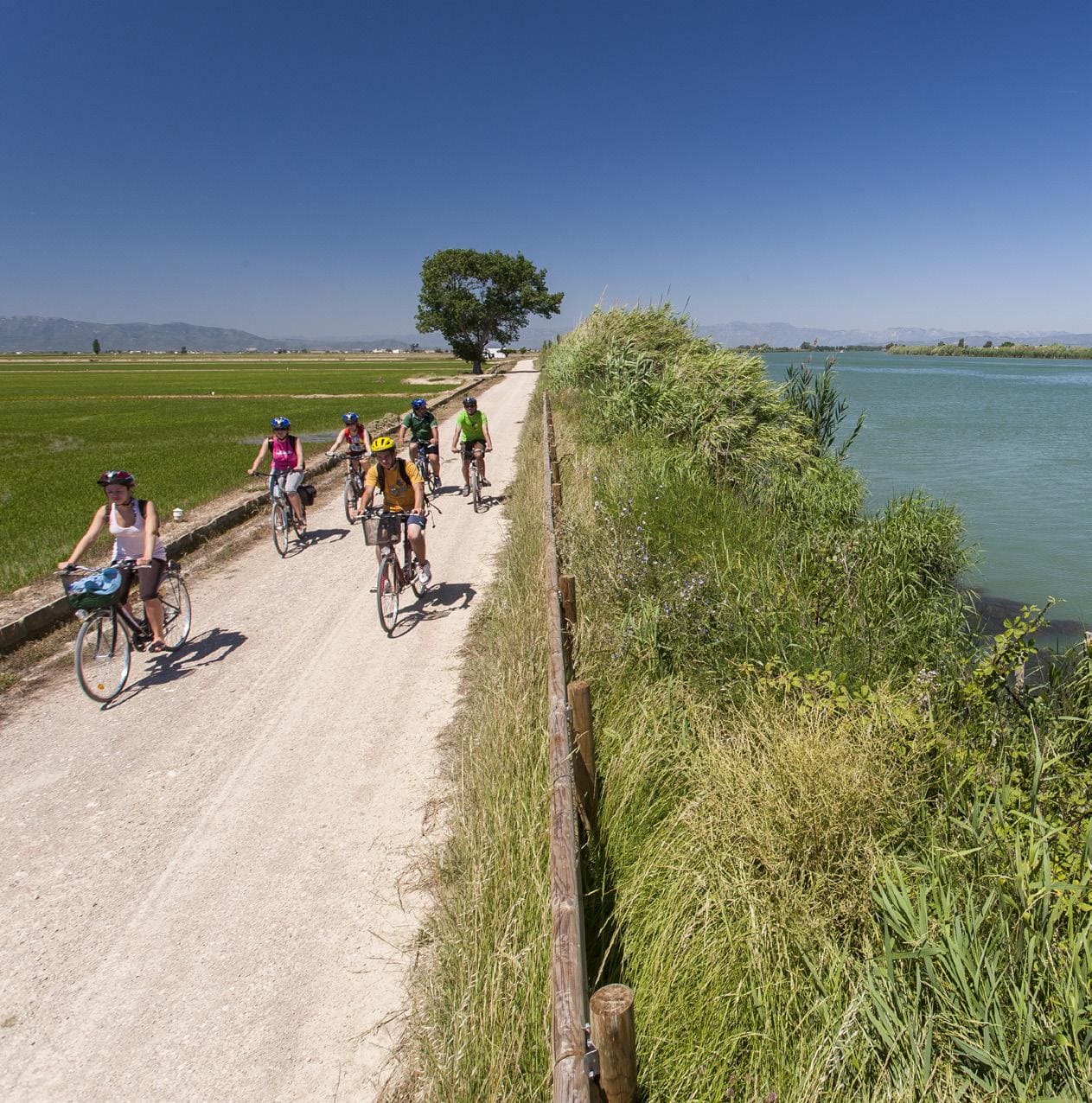
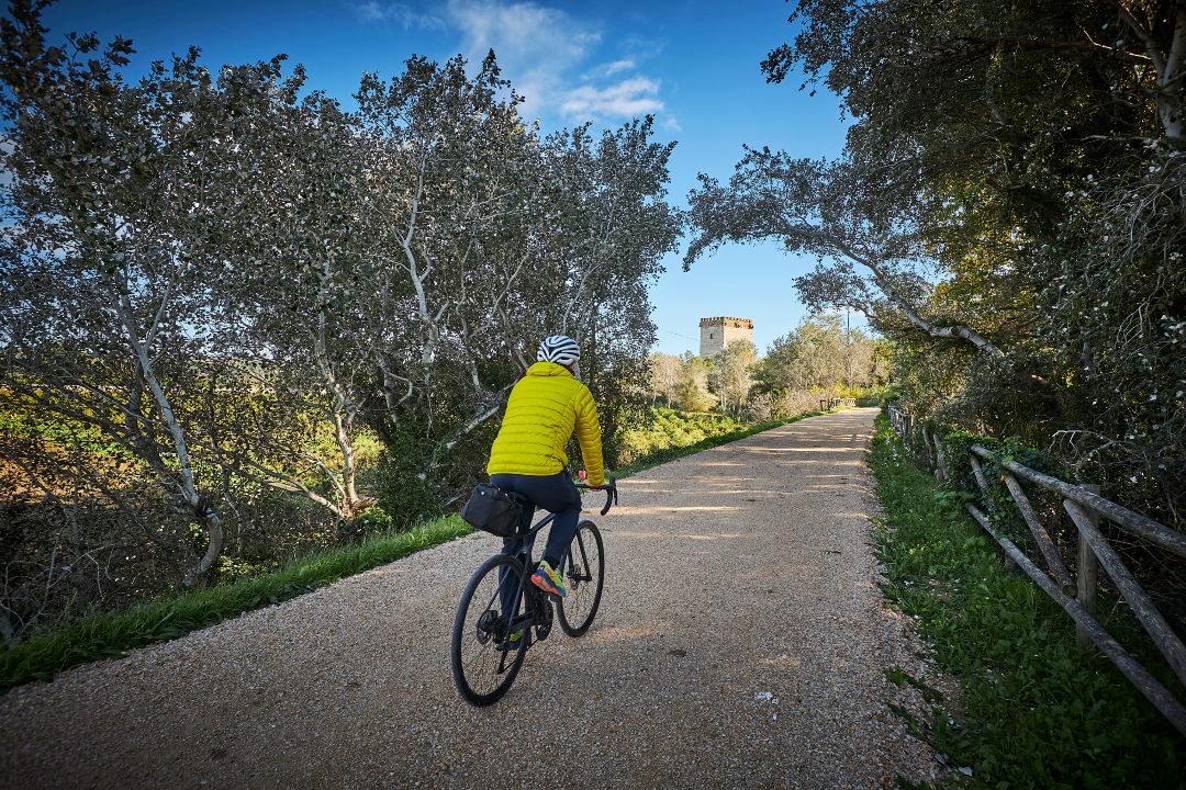
Cycling route through the Ebro Delta Natural Park
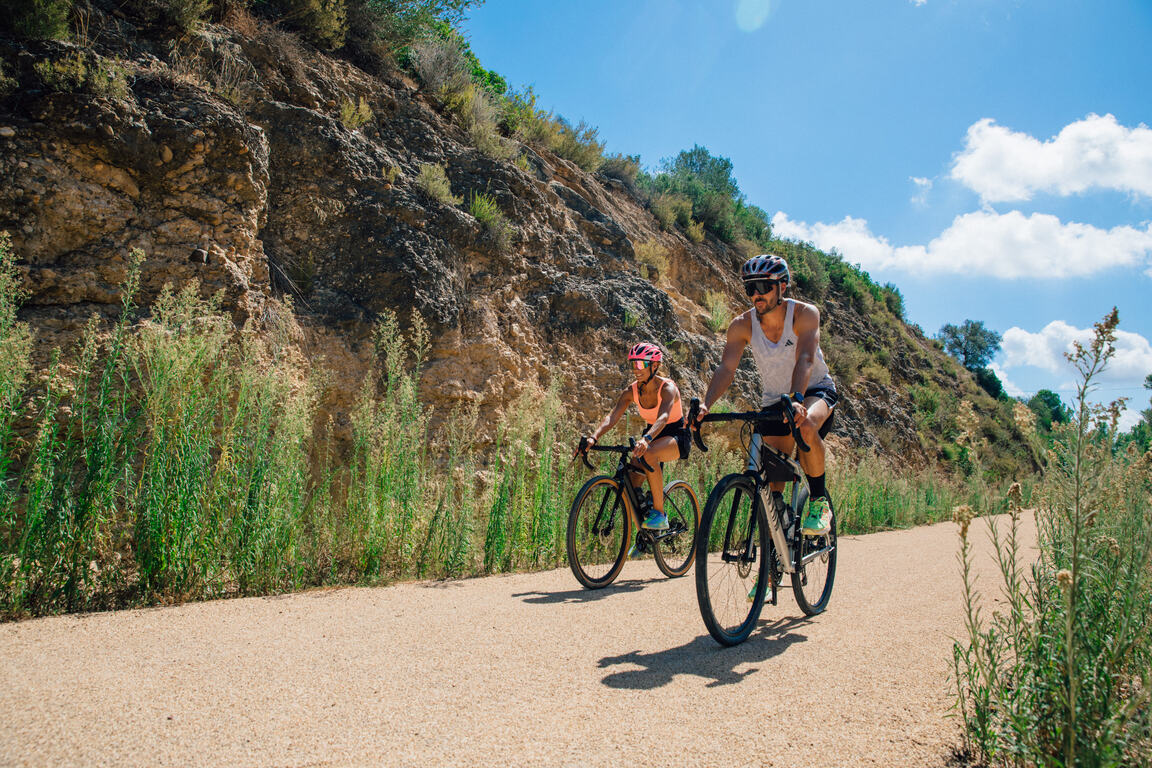
Route characteristics
- 31,4 km
- 2 m
- 5 m
- -1 m
With traffic Motorized vehicles are frequent.

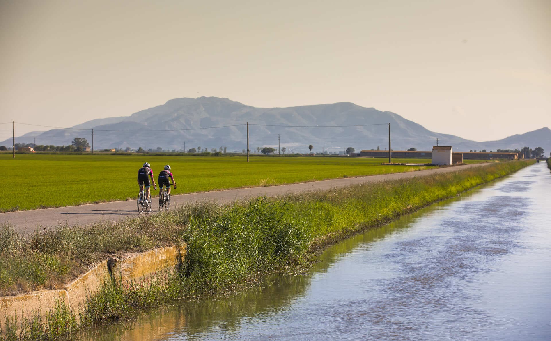
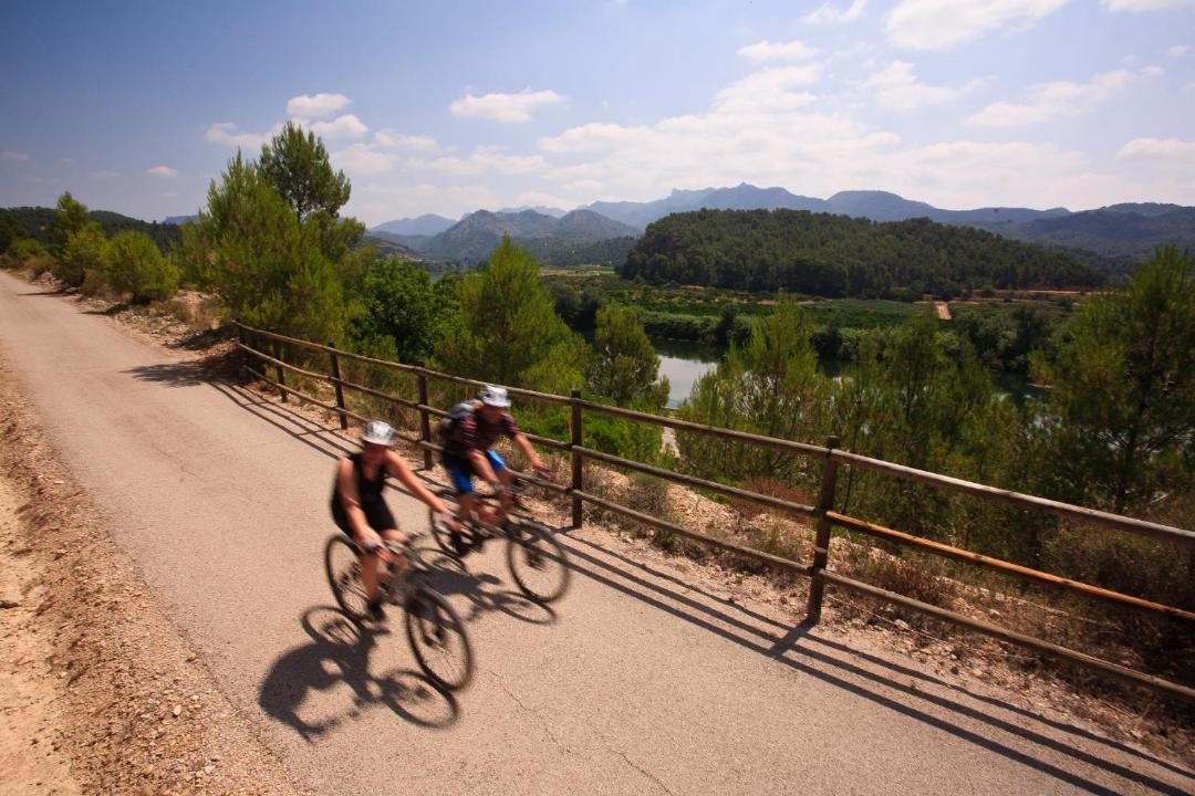
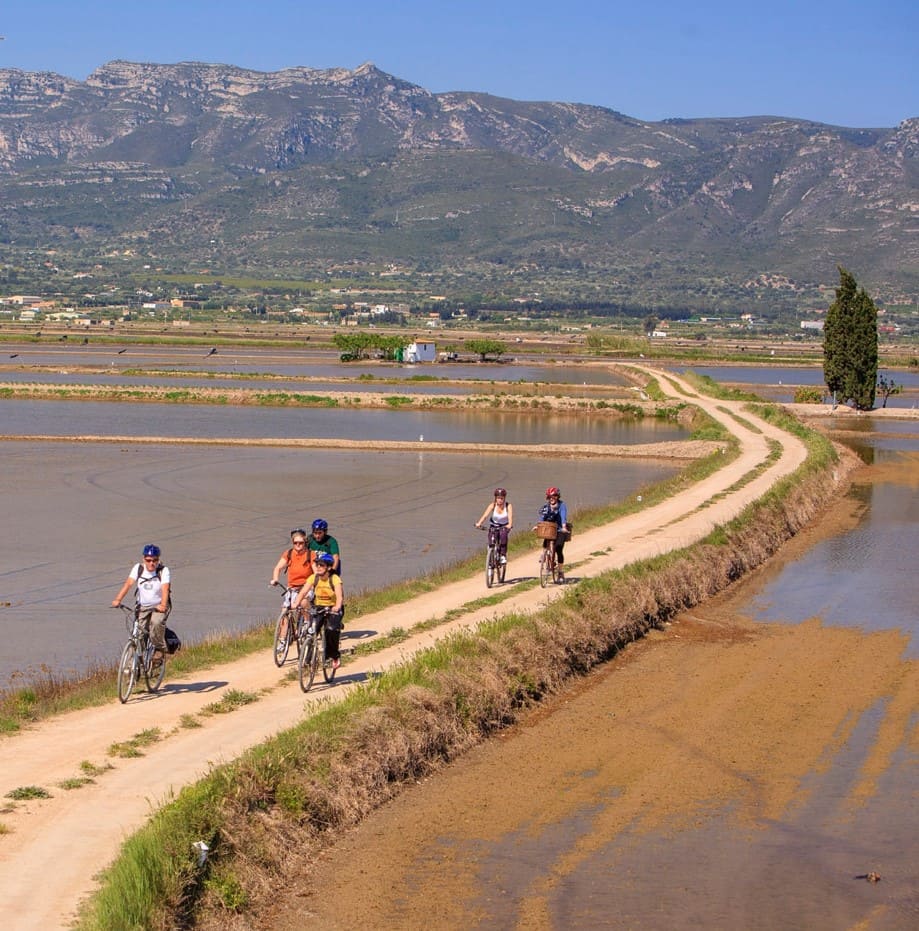
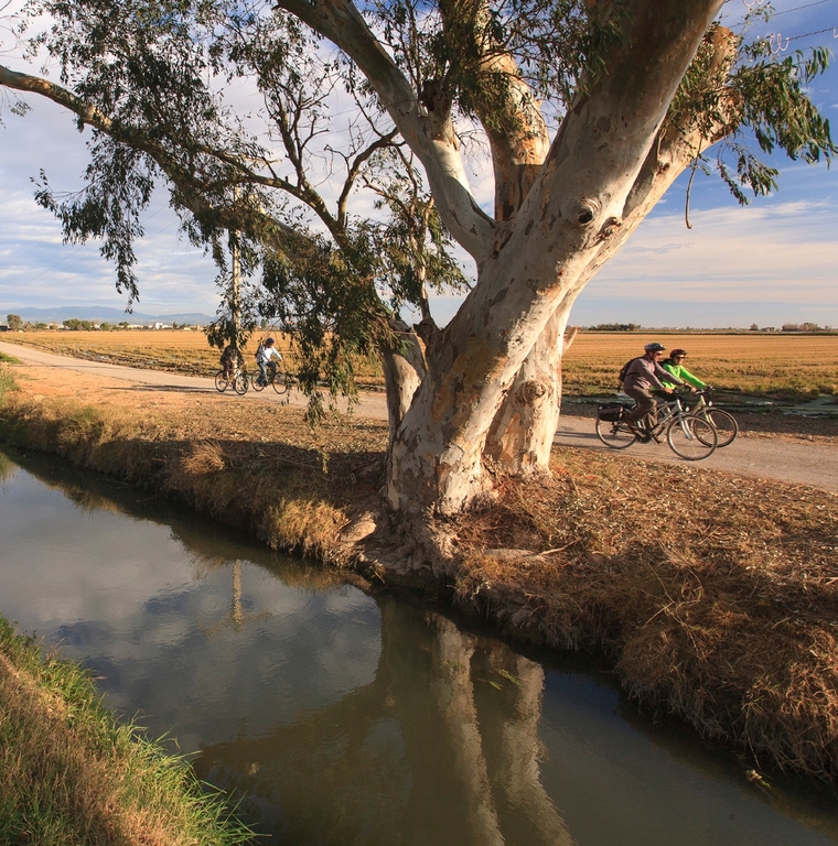
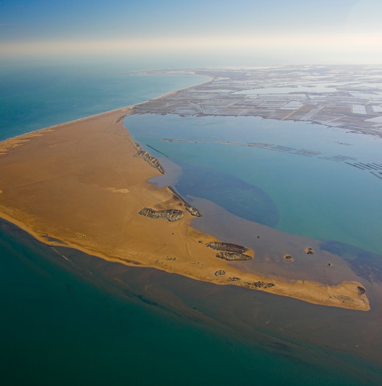
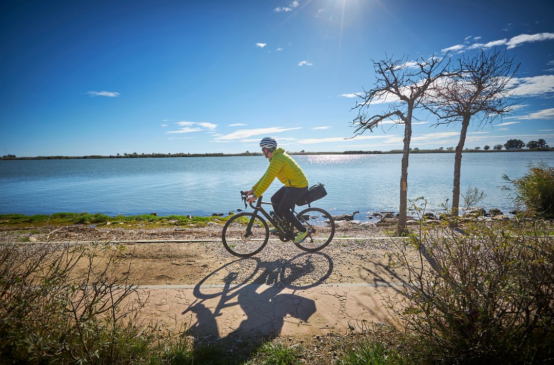
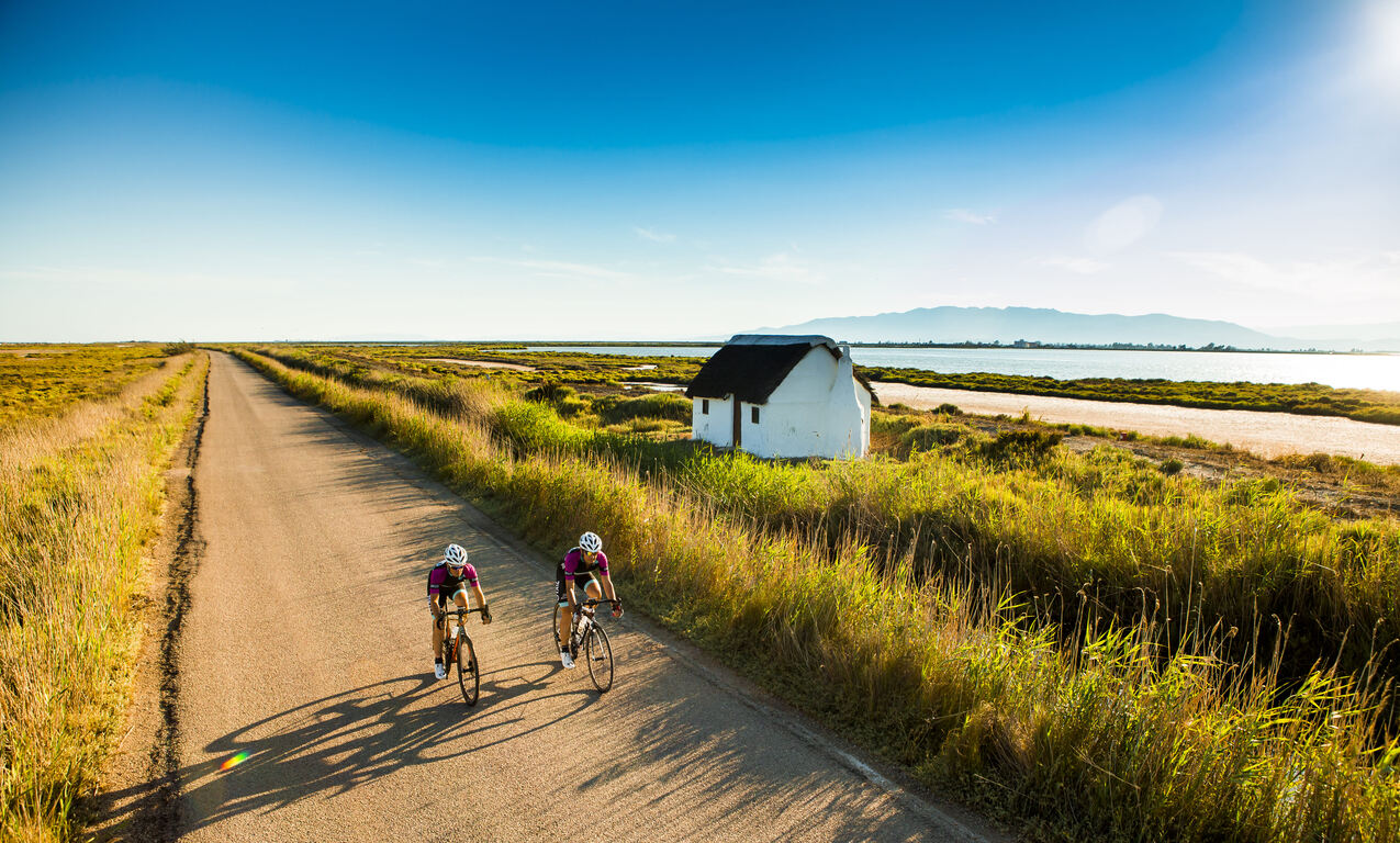
Circular route that connects Deltebre from the Ecomuseum to the mouth of the Ebro River in the Garxal area. Leaving the town along the river promenade and its magnificent views of the river space, the route enters the rice fields that extend between the Canal Vell pond and the Ebro River. Past the Niño Perdido salt marsh, we enter the village of Riumar and its magnificent dune line in front of the beach. At the Garxal fauna viewpoints you can watch the birds that pass through, while at the Zigurat viewpoint there is one of the few opportunities to gain height and obtain magnificent views over the mouth of the Ebro River. Finally, the route returns to Deltebre passing by the magnificent hydraulic work of the Pont dels Moros.
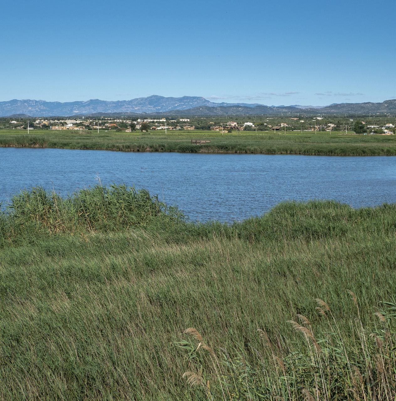
The Ebro Delta is the largest aquatic habitat in Catalonia. The river, the sea, bays, beaches, dunes, salt marshes, riverside forests, ponds and gullies form its natural landscape which, with the rice fields and the vegetable garden, is home to a rich biodiversity. The uniqueness of the Delta is expressed in its physical and natural reality and also in its particular culture, heritage, history and traditions. The Delta is an inspiring example of how we can maintain a balance between sustainability and development to continue enjoying a fair and acceptable lifestyle.
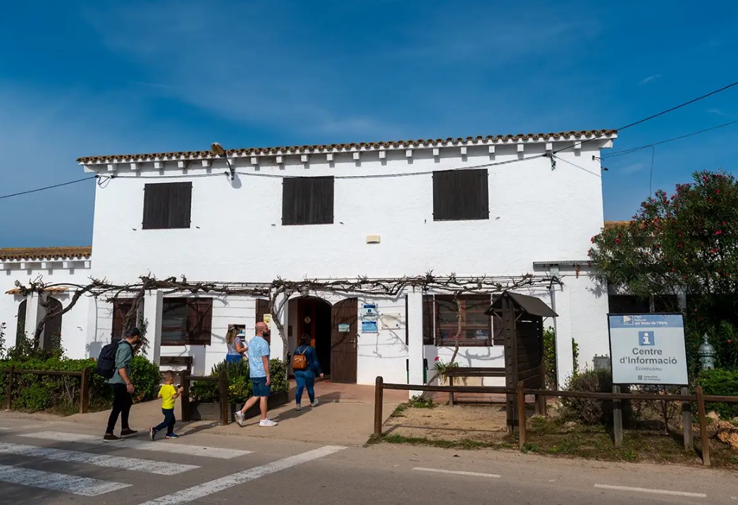
Ecomuseum
Park information center. It houses inside a representation of the main natural and humanized environments of the Delta, in addition to a magnificent aquarium.
Ebro River
After traveling more than 900 km, the Ebro reaches the Mediterranean Sea and creates one of the most important deltas of this sea, with a surface of 320 km²
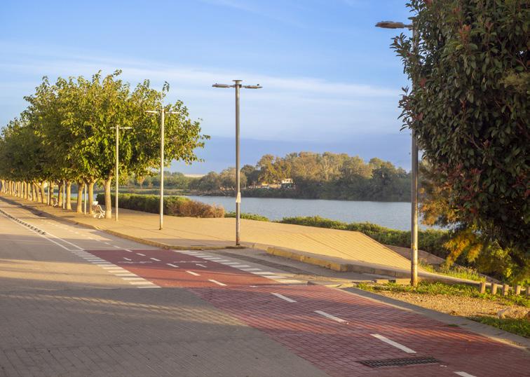
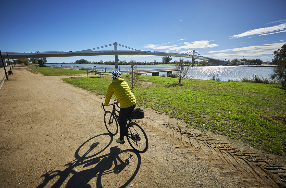
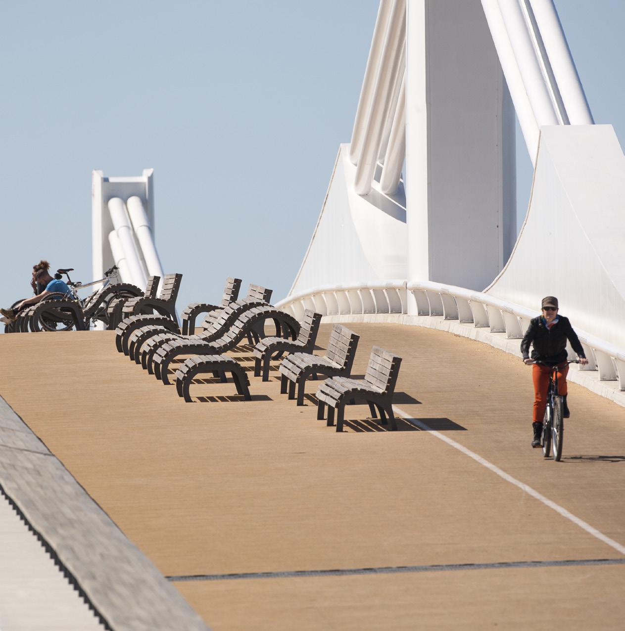
Ebro river promenade
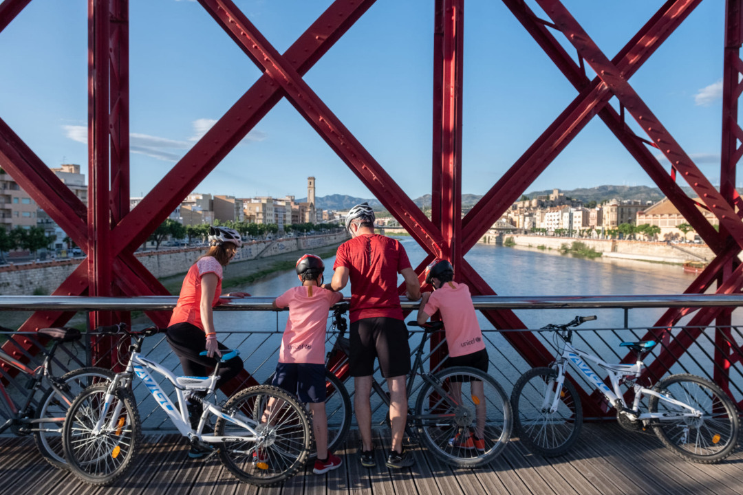
Walk along the right bank of the Ebro with wonderful views of the river and the Hanging Bridge, which began construction in 1915. You also pass under the N-340 bridge.
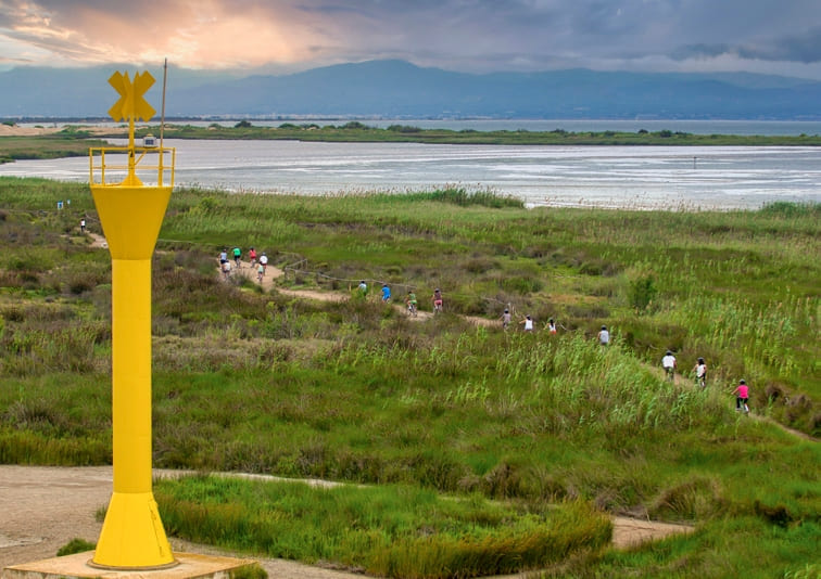
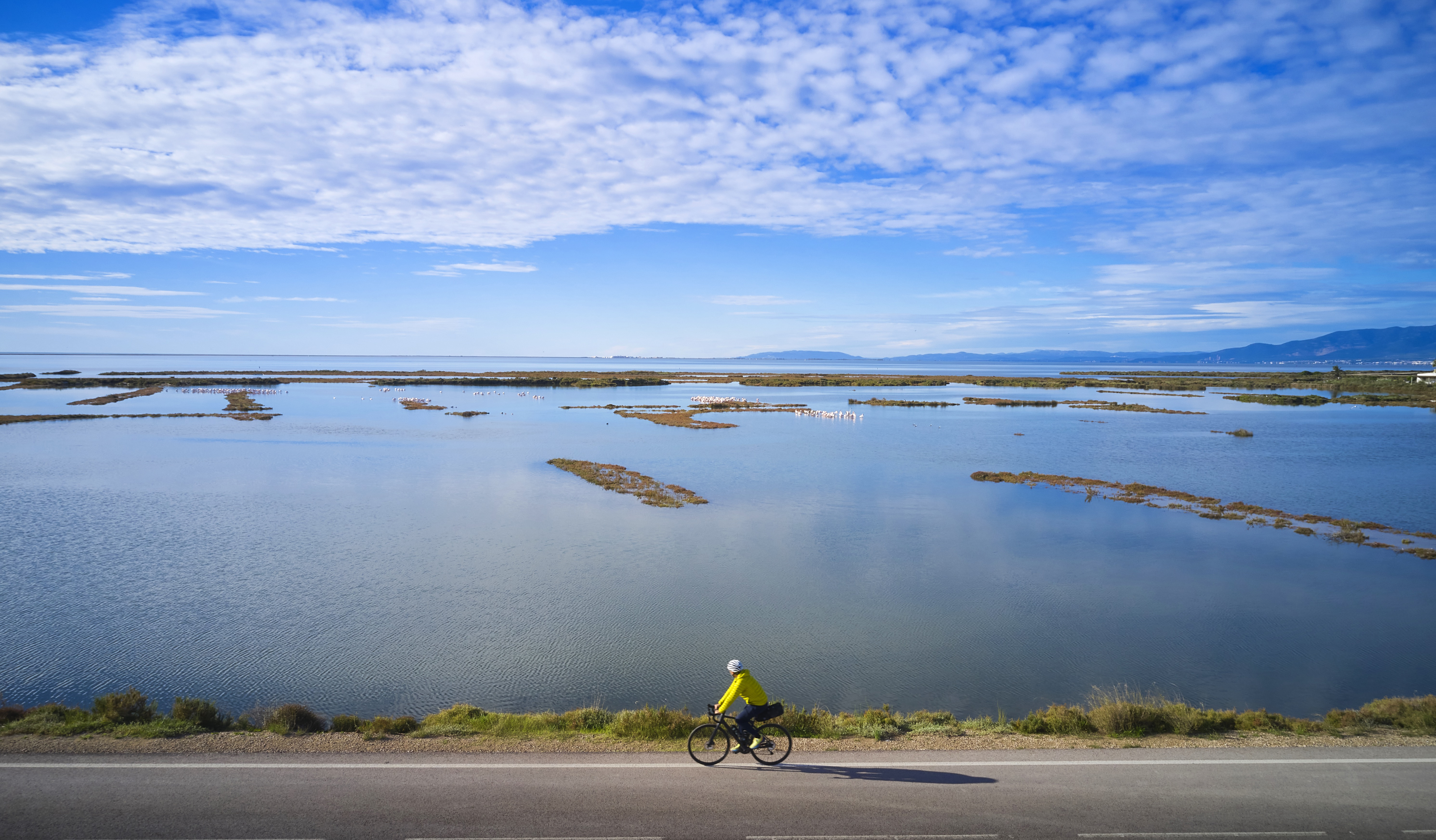
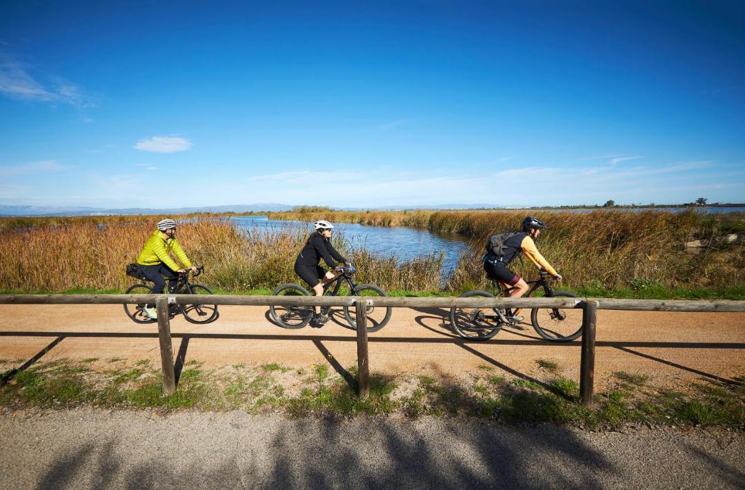
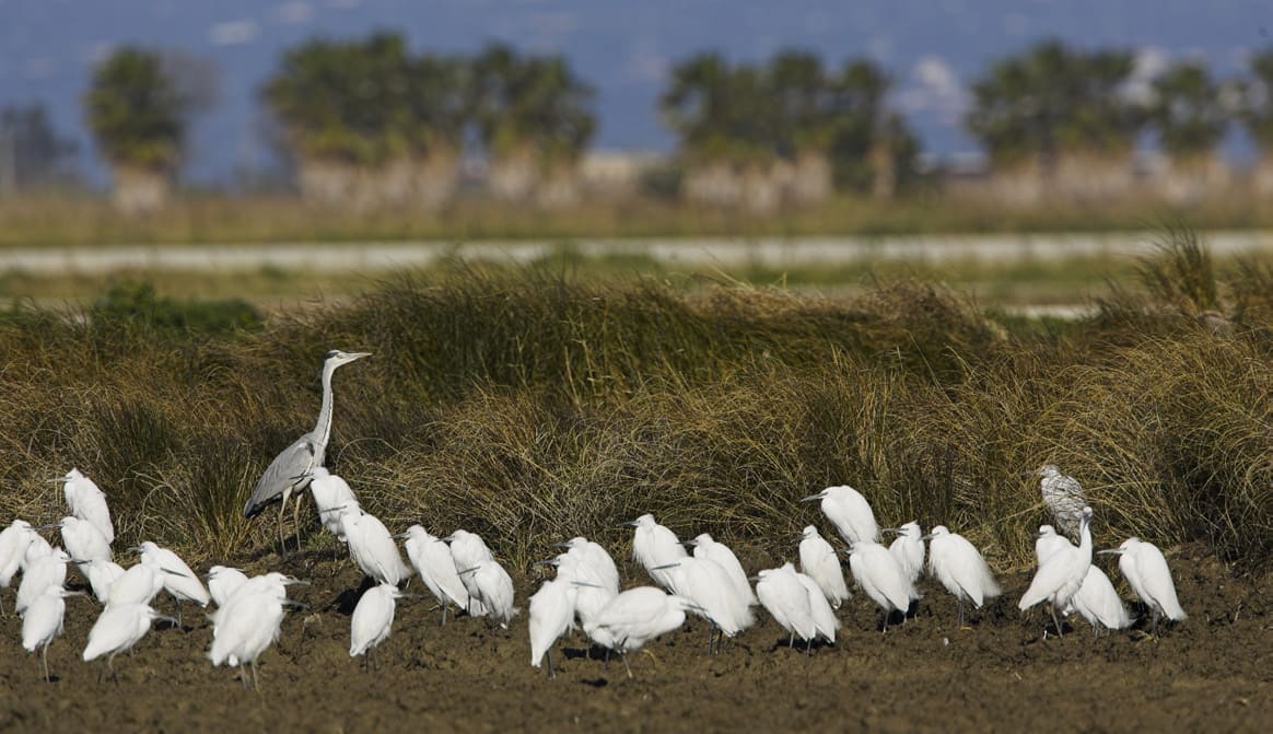
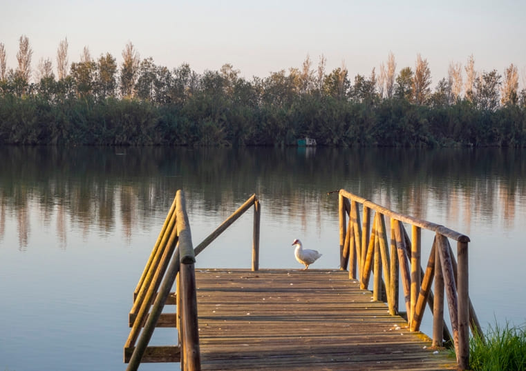
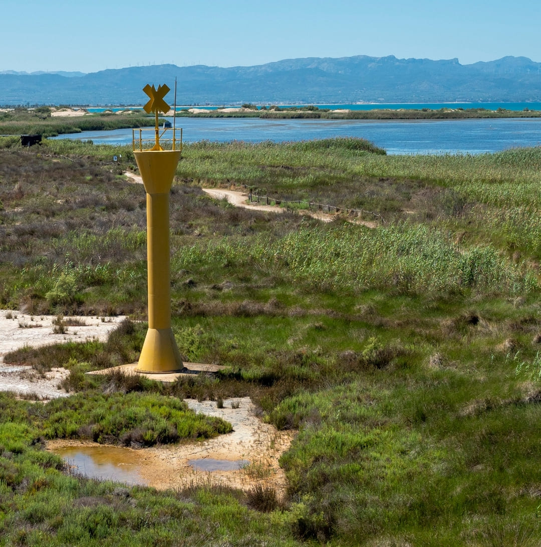
Garxal Pond
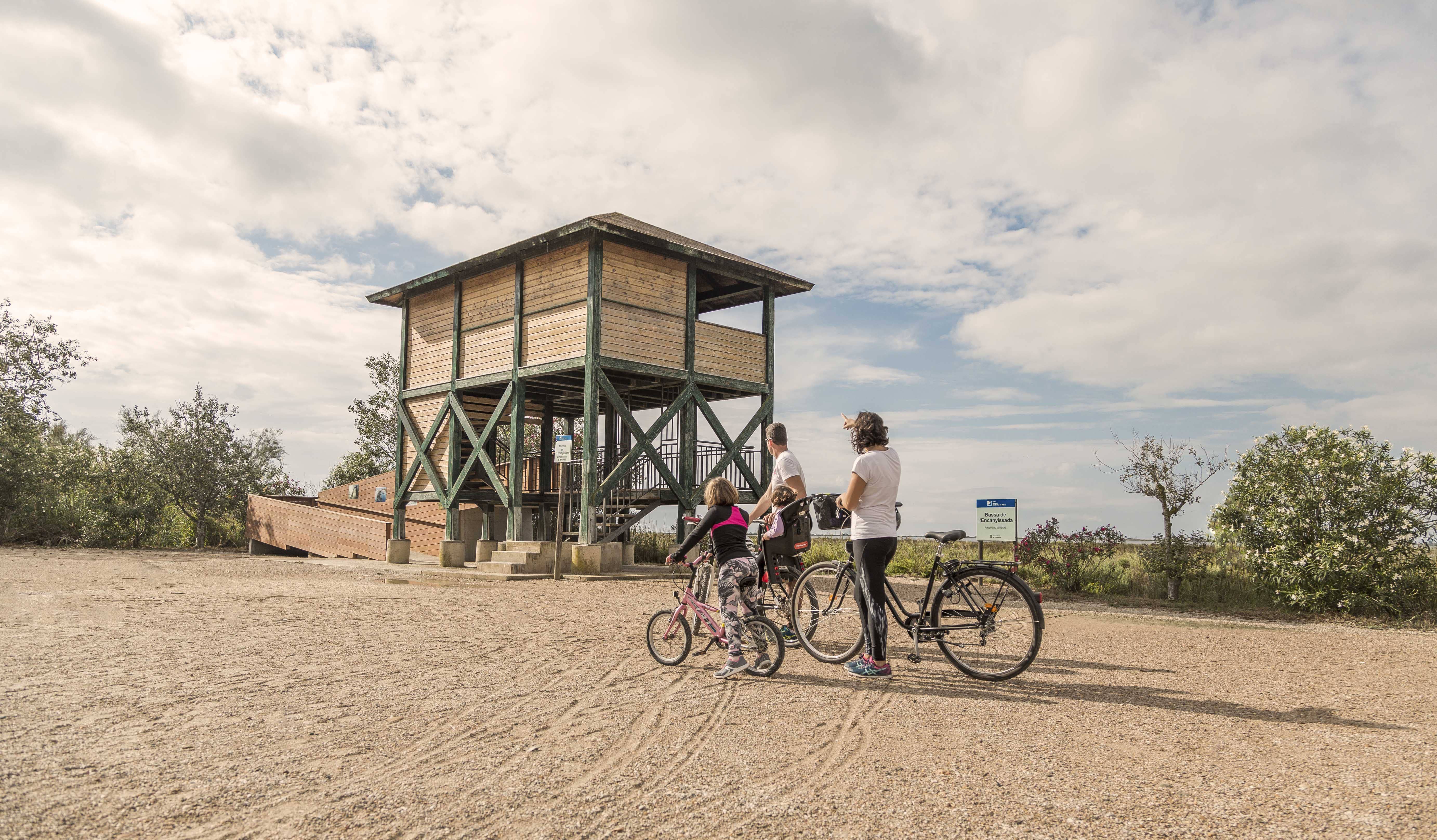
The most recently formed Delta basin. Surrounded by dune areas, salt marshes and reed beds that host a rich and varied flora and fauna that can be observed from several viewpoints.
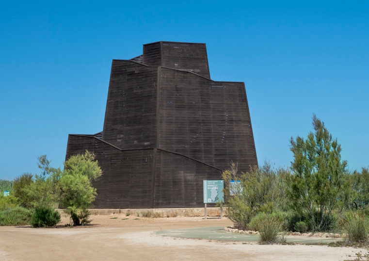
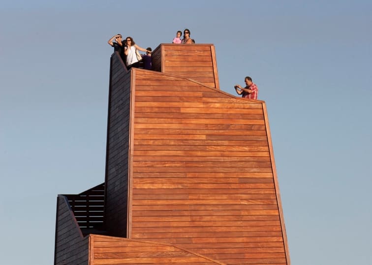
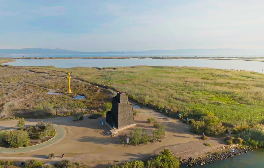
Ziggurat Viewpoint
A wooden viewpoint about 12 m high located at the mouth of the Ebro. It was inaugurated in 2015 and is one of the most popular points of interest in the Delta. It offers unbeatable panoramic views.
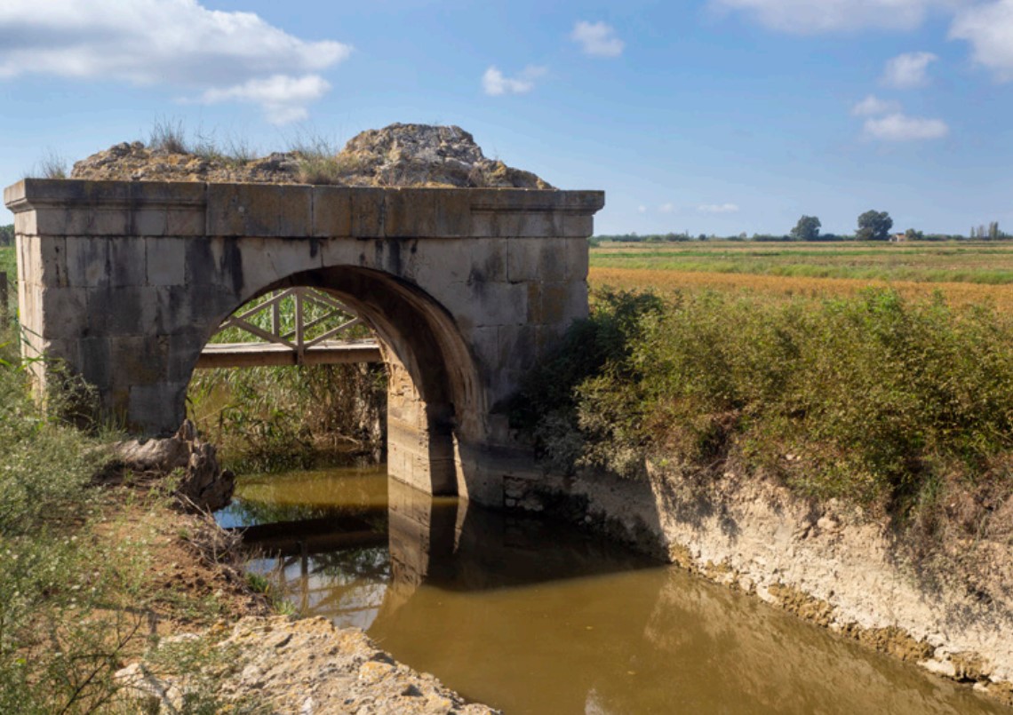
Moors' Bridge
Remains of two semicircular arches made of rough stone, part of a gate or sluice that regulated the water of ancient salt pans near the Ebro River.
Tips
- You are entering a natural area shared with an agricultural community; learn about the values of the area at the Park’s information centers: the Ecomuseum (tel. 977 489 679) and the Casa de Fusta (tel. 667 001 382).
- It is necessary to wear a helmet and bring enough food and water. Carry a mobile phone and save battery; in case of emergency, call 112. Depending on the season, it is advisable to bring sunscreen and insect repellent.
- The terrain is completely flat, but be aware of the common winds in the area.
- Check the weather forecast before heading out on the website meteo.cat
- It is advisable to carry puncture repair equipment.
- Use the viewpoints—they will show you the delta landscape. Bring binoculars to observe the birds.


Deltebre is a young municipality located at the edge of the Ebre Delta. This fet, sens dubte, clearly marks the character of the people, and also provides a clue to deduce the orography and the intrinsic characteristics of the population.
- As this is a linear route with various possibilities to park vehicles along the way, you can adjust the itinerary according to your needs and abilities.
- Respect the signage and restricted access areas.
- Lighting fires is strictly prohibited.
- Respect the flora, fauna, and environment. Collecting animal or plant species, whether alive or dead, is not allowed.
- Camping is only permitted in established campsites.
- In protected areas, dogs must be kept on a leash.
The take-off and landing of drones is prohibited. - Littering is prohibited, except in designated areas.
THE ZAFÁN GREENWAY GAME
Explore, learn, and have fun with Antoni and Clara as you travel the routes of the Zafán Valley. Each stop is a new adventure, every challenge a story waiting for you!
Comença a jugar!Along your route, you'll find challenges and activities to earn points, solve clues, or win virtual prizes.
Join our games and become an expert on the Zafán Greenway.
Available games (2)
Observe birds
Find the bird-watching spot along the route, scan the QR code, and answer three questions to earn your badge.
More informationPhotograph shells
Upload a photo to Instagram of the shells you find on the beach using the hashtag #conchasdelFalgar
More information
Weather forecast
Today, Wednesday, Deltebre

Clear
15 km/h
0ºC max
100ºC min
No rain forecast
Next days forecast

Wednesday
31º max
24º min
Thursday
31º max
25º min
Friday
29º max
25º min
Saturday
29º max
26º min
Other routes you may like...
La Ràpita - Amposta - L'Aldea - Camarles - L'Ampolla (Porta del Delta)